
Image: KernRiverMap

Size of this preview: 745 × 600 pixels. Other resolutions: 298 × 240 pixels | 758 × 610 pixels.
Original image (758 × 610 pixels, file size: 92 KB, MIME type: image/png)
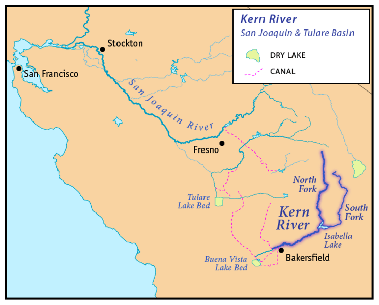
Description: This is a map of the Kern River - Kern County, California. I, Pfly, created it using USGS data from the National Map project, processed with ArcGIS as a basemap, then redrawn with Adobe Illustrator and Adobe Photoshop. I also consulted the Benchmark Maps atlas of California.
Title: KernRiverMap
Credit: Own work
Author: Pfly
Usage Terms: Creative Commons Attribution-Share Alike 4.0
License: CC BY-SA 4.0
License Link: https://creativecommons.org/licenses/by-sa/4.0
Attribution Required?: Yes
Image usage
The following 4 pages link to this image:

All content from Kiddle encyclopedia articles (including the article images and facts) can be freely used under Attribution-ShareAlike license, unless stated otherwise.