
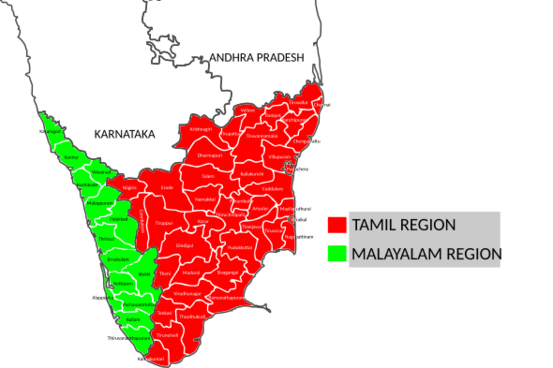
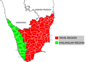
Image: Kerala and Tamil Nadu - combined district map

Size of this PNG preview of this SVG file: 553 × 368 pixels. Other resolution: 320 × 213 pixels.
Original image (SVG file, nominally 553 × 368 pixels, file size: 353 KB)
Description: A major part of ancient Thamizhakam today lies in the states of Kerala and Tamil Nadu. The main languages spoken today are Tamil and Malayalam
Title: Kerala and Tamil Nadu - combined district map
Credit: Own work
Author: Kambliyil
Usage Terms: Creative Commons Attribution-Share Alike 4.0
License: CC BY-SA 4.0
License Link: https://creativecommons.org/licenses/by-sa/4.0
Attribution Required?: Yes
Image usage
The following page links to this image:

All content from Kiddle encyclopedia articles (including the article images and facts) can be freely used under Attribution-ShareAlike license, unless stated otherwise.