
Image: Kentucky County, Virginia 1776
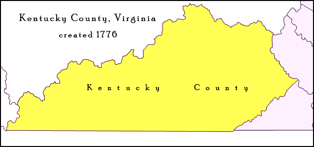
Description: Map of Trans-Appalachian Virginia as it was from 1776 to 1780. Kentucky County (then alternately spelled Kentucke County) was created by the Commonwealth of Virginia from the western portion of Fincastle County beyond the Cumberland Mountains effective December 31, 1776, and was in existence until June 30, 1780, when it was subdivided and abolished.
Title: Kentucky County, Virginia 1776
Credit: Own work; map detail from Virginia's Western Counties 1776, Geographic Materials: Neal Hammon Series, Office of the Kentucky Secretary of State, Frankfort, Kentucky.
Author: Drdpw
Usage Terms: Creative Commons Attribution-Share Alike 4.0
License: CC BY-SA 4.0
License Link: https://creativecommons.org/licenses/by-sa/4.0
Attribution Required?: Yes
Image usage
The following page links to this image:
