
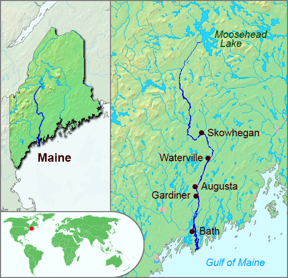
Image: Kennebec River Map
No higher resolution available.
Kennebec_River_Map.png (576 × 557 pixels, file size: 134 KB, MIME type: image/png)
Description: The underlying topographic maps used in this image come from the Demis Web Map Server, and are in the public domain. The world locator map is derived from BlankMap-World.png. I added the feature layers myself. —Papayoung 22:12, 26 September 2005 (UTC)
Title: Kennebec River Map
Credit: Transferred from en.wikipedia to Commons by Pauk using CommonsHelper.
Author: The original uploader was Papayoung at English Wikipedia
Usage Terms: Creative Commons Attribution-Share Alike 3.0
License: CC-BY-SA-3.0
License Link: http://creativecommons.org/licenses/by-sa/3.0/
Attribution Required?: Yes
Image usage
The following 6 pages link to this image:

All content from Kiddle encyclopedia articles (including the article images and facts) can be freely used under Attribution-ShareAlike license, unless stated otherwise.