
Image: Kassite Babylonia EN

Size of this PNG preview of this SVG file: 661 × 580 pixels. Other resolution: 274 × 240 pixels.
Original image (SVG file, nominally 661 × 580 pixels, file size: 177 KB)
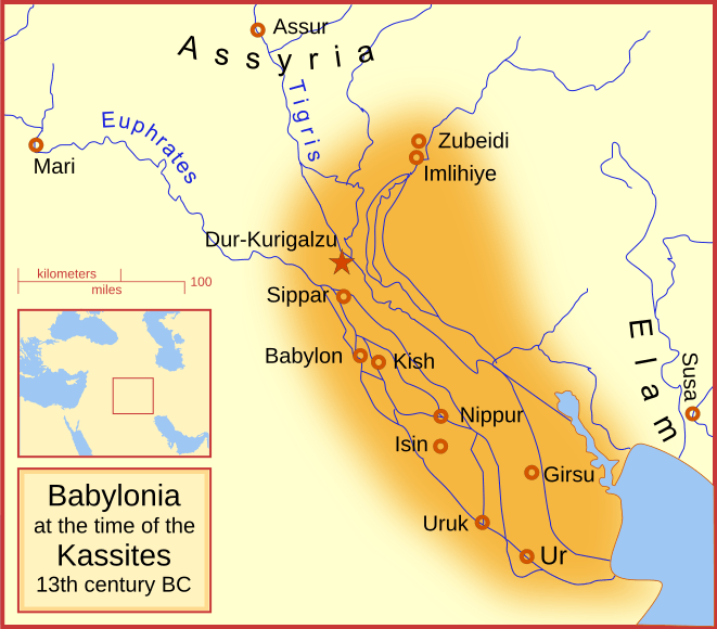
Description: A map of the Babylonian Empire during the time of the Kassites, roughly the 13th century BC. This map shows the probable river courses and coastline at that time.
Title: Kassite Babylonia EN
Credit: Own work
Author: MapMaster
Usage Terms: GNU Free Documentation License
License: GFDL
License Link: http://www.gnu.org/copyleft/fdl.html
Attribution Required?: Yes
Image usage
The following 2 pages link to this image:

All content from Kiddle encyclopedia articles (including the article images and facts) can be freely used under Attribution-ShareAlike license, unless stated otherwise.