
Image: Karte - Kesselschlachte bei Vjazma und Brjansk 1941
Size of this preview: 441 × 599 pixels. Other resolutions: 177 × 240 pixels | 2,002 × 2,718 pixels.
Original image (2,002 × 2,718 pixels, file size: 1.56 MB, MIME type: image/png)
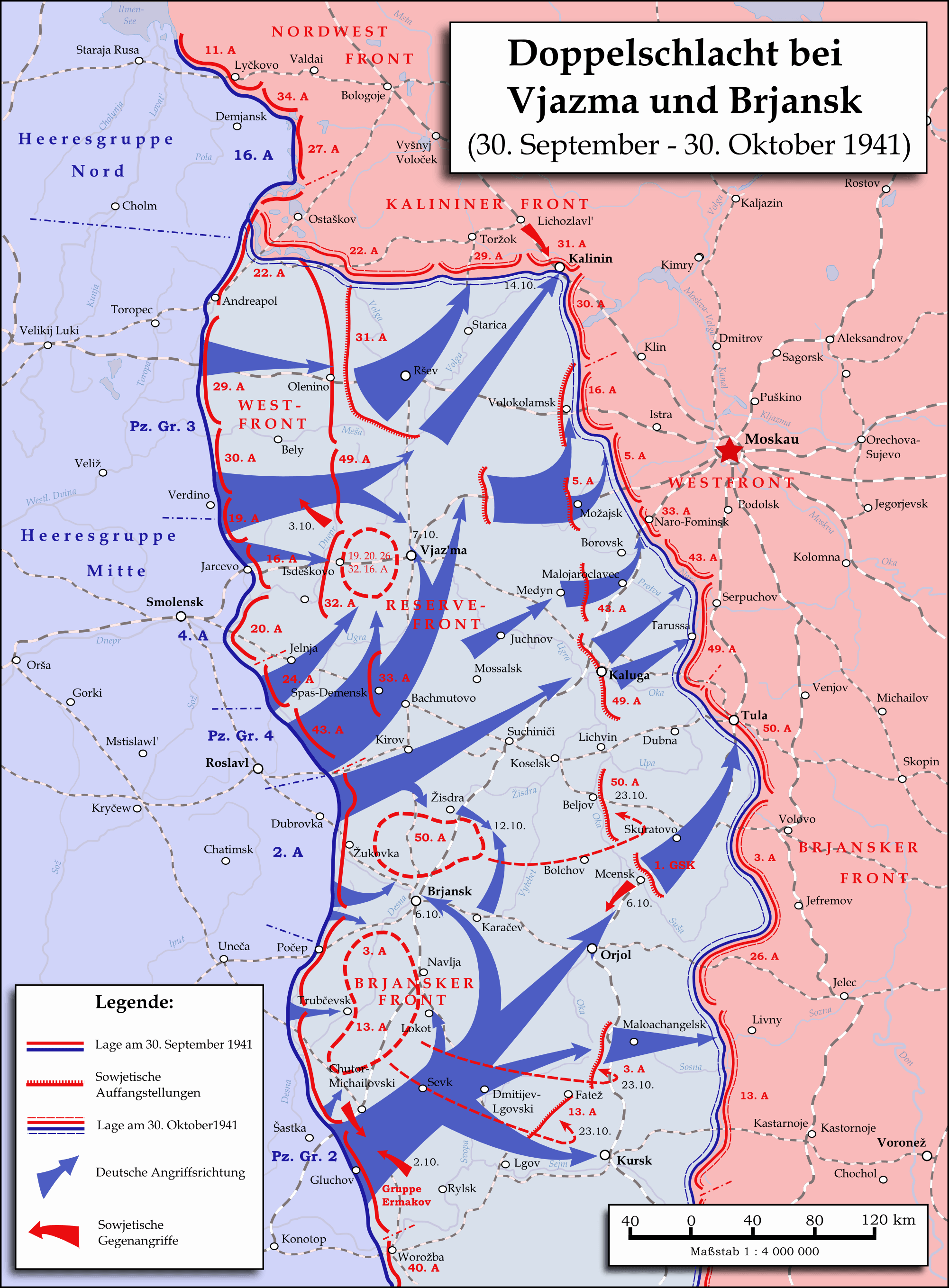
Description: Map showing the Twin-Battlea near Vyazma (October 2nd — October 20th 1941) and Brjansk (September 30th - Octpber, 23rd) during the Second World War (1939—1945) at the Eastern Front. The map is created by Inkscape and is based on the Map 30 in the attachement of the book P.N. Pospelow (Hrsg.): Geschichte des Großen Vaterländischen Krieges der Sowjetunion, Bd.2, Berlin (Ost) 1963. The troop movements have been corrected.
Title: Karte - Kesselschlachte bei Vjazma und Brjansk 1941
Credit: Own work
Author: Memnon335bc
Usage Terms: Creative Commons Attribution 3.0
License: CC BY 3.0
License Link: https://creativecommons.org/licenses/by/3.0
Attribution Required?: Yes
Image usage
The following page links to this image:

All content from Kiddle encyclopedia articles (including the article images and facts) can be freely used under Attribution-ShareAlike license, unless stated otherwise.