Image: Kampeska bathymetry 2002

Size of this PNG preview of this SVG file: 642 × 547 pixels. Other resolution: 282 × 240 pixels.
Original image (SVG file, nominally 642 × 547 pixels, file size: 131 KB)
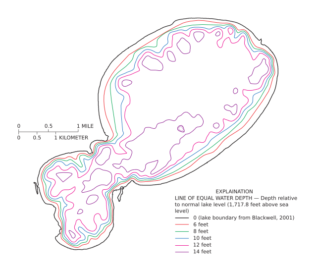
Description: Lake Kampeska water depth map from a USGS report published in 2002.
Title: Kampeska bathymetry 2002
Credit: http://pubs.usgs.gov/wri/wri024171/pdf/lakekampeska.pdf Sediment Accumulation and Distribution in Lake Kampeska, Watertown, South Dakota Water-Resources Investigations Report 02-4171 Prepared by Bryan D. Schaap and Steven K. Sando. Figure 18, Page 37.
Author: Prepared by Bryan D. Schaap and Steven K. Sando.
Usage Terms: Public domain
License: PD
Attribution Required?: No
Image usage
The following page links to this image:

All content from Kiddle encyclopedia articles (including the article images and facts) can be freely used under Attribution-ShareAlike license, unless stated otherwise.
