Image: KYphysiography

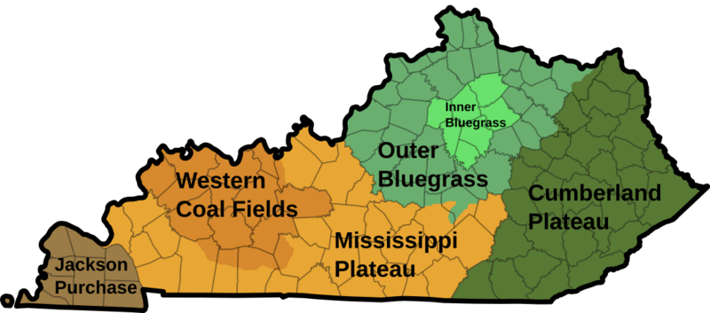
Description: I created this image using Wikipedia's map of Kentucky counties. Dark green - Eastern Kentucky Coal fields (Cumberland Plateau) Green - Outer Bluegrass Light green - Inner Bluegrass Light brown - Mississippi (Pennyroyal) Plateau Brown - Western Kentucky Coal Field Dark brown - Jackson Purchase / en:Gulf Coastal Plain
Title: KYphysiography
Credit: Own based on: File:Kentucky time zones.svg
Author: Original: Lamontacranston Vector: TheWanderingTraders
Permission: Public domainPublic domainfalsefalse This work has been released into the public domain by its author, Lamontacranston at English Wikipedia. This applies worldwide. In some countries this may not be legally possible; if so: Lamontacranston grants anyone the right to use this work for any purpose, without any conditions, unless such conditions are required by law.Public domainPublic domainfalsefalse
Usage Terms: Public domain
License: Public domain
Attribution Required?: No
Image usage
The following page links to this image:

