
Image: Journal.pone.0024024.g001-1
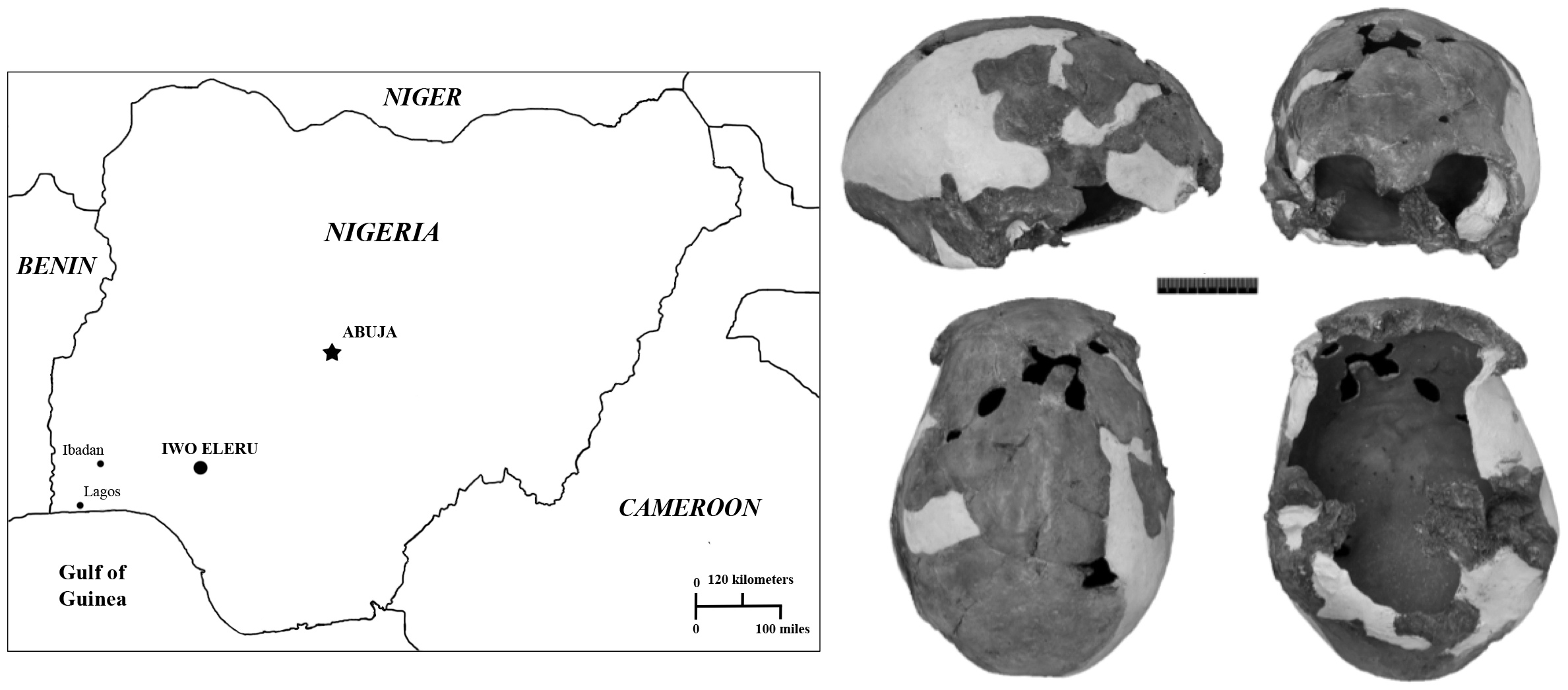
Description: Map of Nigeria, showing the geographic location of the Iwo Eleru rockshelter, and the Iwo Eleru calvaria. Clockwise from top left: Lateral, frontal, ventral and superior views.
Title: Journal.pone.0024024.g001-1
Credit: Figure 1 in: Harvati K, Stringer C, Grün R, Aubert M, Allsworth-Jones P, et al. (2011) The Later Stone Age Calvaria from Iwo Eleru, Nigeria: Morphology and Chronology. PLoS ONE 6(9): e24024 http://journals.plos.org/plosone/article?id=10.1371/journal.pone.0024024
Author: Harvati K, Stringer C, Grün R, Aubert M, Allsworth-Jones P, et al.
Usage Terms: Creative Commons Attribution 4.0
License: CC BY 4.0
License Link: https://creativecommons.org/licenses/by/4.0
Attribution Required?: Yes
Image usage
The following page links to this image:
