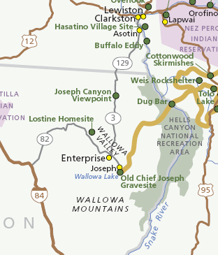
Image: Joseph Canyon Map
Joseph_Canyon_Map.gif (312 × 365 pixels, file size: 25 KB, MIME type: image/gif)
Description: Map of the Nez Perce National Historical Park visitor stop locations, in eastern Oregon and Washington (state). Also showing the Hells Canyon National Recreation Area, viewpoints for Joseph Canyon, and other features of the Nez Perce region.
Title: Joseph Canyon Map
Credit: National Park Service, Nez Perce National Historical Park Map
Author: National Park Service
Permission: public domain
Usage Terms: Public domain
License: Public domain
Attribution Required?: No
Image usage
The following page links to this image:

All content from Kiddle encyclopedia articles (including the article images and facts) can be freely used under Attribution-ShareAlike license, unless stated otherwise.

