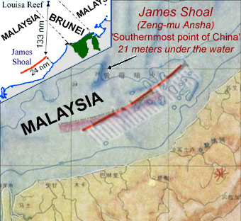
Image: James Shoal Dash location in 2009 & 1984 maps
James_Shoal_Dash_location_in_2009_&_1984_maps.jpg (340 × 312 pixels, file size: 42 KB, MIME type: image/jpeg)
Description: China's Nine-dash line. Dash 4 location in 2009 (solid red) & 1984 maps. Dash 4 is 24 nm from the coast of Malaysia on the island of Borneo. Dash 4 is 133 nm from Louisa Reef. James Shoal (Zeng-mu Ansha), the "Southernmost point of China", is 21 meters under the water
Usage Terms: Public domain
Image usage
The following page links to this image:

All content from Kiddle encyclopedia articles (including the article images and facts) can be freely used under Attribution-ShareAlike license, unless stated otherwise.

