
Image: IsleRoyaleAgreement

Size of this preview: 800 × 582 pixels. Other resolutions: 320 × 233 pixels | 1,100 × 800 pixels.
Original image (1,100 × 800 pixels, file size: 567 KB, MIME type: image/jpeg)
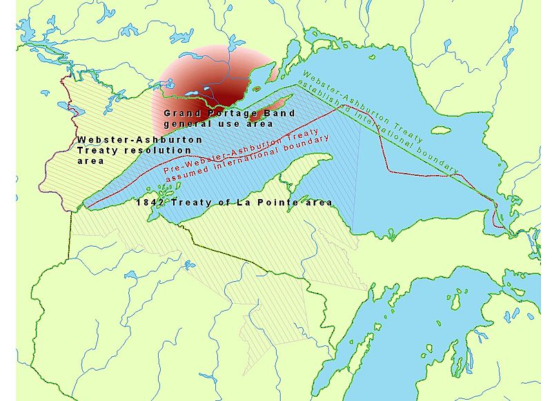
Description: Map of Lake Superior region showing the 1842 Webster-Ashburton Treaty area and the 1842 Treaty of La Pointe area, their overlap over Isle Royale, which precipitated the need for the 1844 Isle Royale Agreement with the adhesion of the Grand Portage Band to the 1842 Treaty of La Pointe.
Title: IsleRoyaleAgreement
Credit: Own work
Author: CJLippert
Usage Terms: Public domain
License: Public domain
Attribution Required?: No
Image usage
The following page links to this image:

All content from Kiddle encyclopedia articles (including the article images and facts) can be freely used under Attribution-ShareAlike license, unless stated otherwise.