
Image: IsleDeMontreal1764
Size of this preview: 800 × 468 pixels. Other resolutions: 320 × 187 pixels | 1,447 × 846 pixels.
Original image (1,447 × 846 pixels, file size: 999 KB, MIME type: image/png)
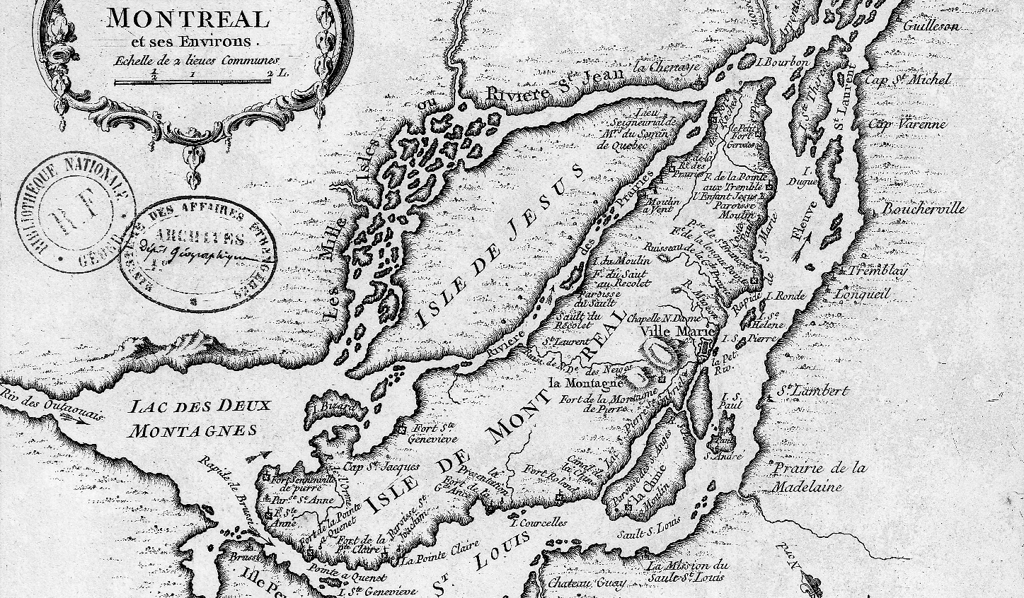
Description: This is a detail of the original source map, cropped to depict primarily the Isle of Montreal and immediately surrounding mainland. The map's caption reads "Montreal et ses Environs" (Montreal and its environs).
Title: IsleDeMontreal1764
Credit: Bibliothèque Nationale de France http://gallica2.bnf.fr/ark:/12148/btv1b67001778
Author: Bellin, Jacques-Nicolas, for the Kingdom of France
Usage Terms: Public domain
License: Public domain
Attribution Required?: No
Image usage
The following page links to this image:

All content from Kiddle encyclopedia articles (including the article images and facts) can be freely used under Attribution-ShareAlike license, unless stated otherwise.