
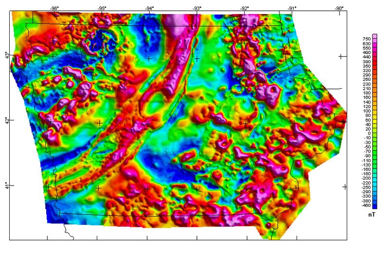
Image: Iowa magnetic map

Size of this preview: 800 × 521 pixels. Other resolutions: 320 × 209 pixels | 884 × 576 pixels.
Original image (884 × 576 pixels, file size: 598 KB, MIME type: image/jpeg)
Description: Iowa Composite Magnetic Anomaly Map (NE illumination) at simulated flight altitude of 305 m (1,000 ft) above ground
Title: Iowa magnetic map
Credit: https://mrdata.usgs.gov/catalog/cite-view.php?cite=64
Author: Kucks, Robert P. and Hill, Patricia L., U.S. Geological Survey
Usage Terms: Public domain
License: Public domain
Attribution Required?: No
Image usage
The following page links to this image:

All content from Kiddle encyclopedia articles (including the article images and facts) can be freely used under Attribution-ShareAlike license, unless stated otherwise.