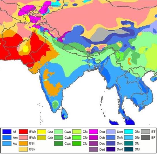
Image: India and South Asia Köppen climate map with legend
Description: South Asia- Köppen-Geiger climate classification map is based on native vegetation, temperature, precipitation and their seasonality.
(Af) Tropical rainforest
(Am) Tropical monsoon
(Aw) Tropical savanna, wet & dry
(BWh) Hot desert
(BWk) Cold desert
(BSh) Hot semi arid
(BSk) Cold semi arid
(Csa) Mediterr. dry, hot summ.
(Cwa) Subtropical humid summ, dry winter
(Cwb) Subtropical highland, dry wint
(Cfa) Subtropical humid summ (no dry)
Author: File:World Köppen Map.png: Original file by Peel, M. C., Finlayson, B. L., and McMahon, T. A. (University of Melbourne). Derivative work: Modifications by user Br-Sc-94, (User talk). Cropping & addition of map legend-color box-to summary info by 2know4power, (User talk).
Usage Terms: Creative Commons Attribution-Share Alike 3.0
License: CC-BY-SA-3.0
License Link: http://creativecommons.org/licenses/by-sa/3.0/
Attribution Required?: Yes
Image usage
The following page links to this image:


