
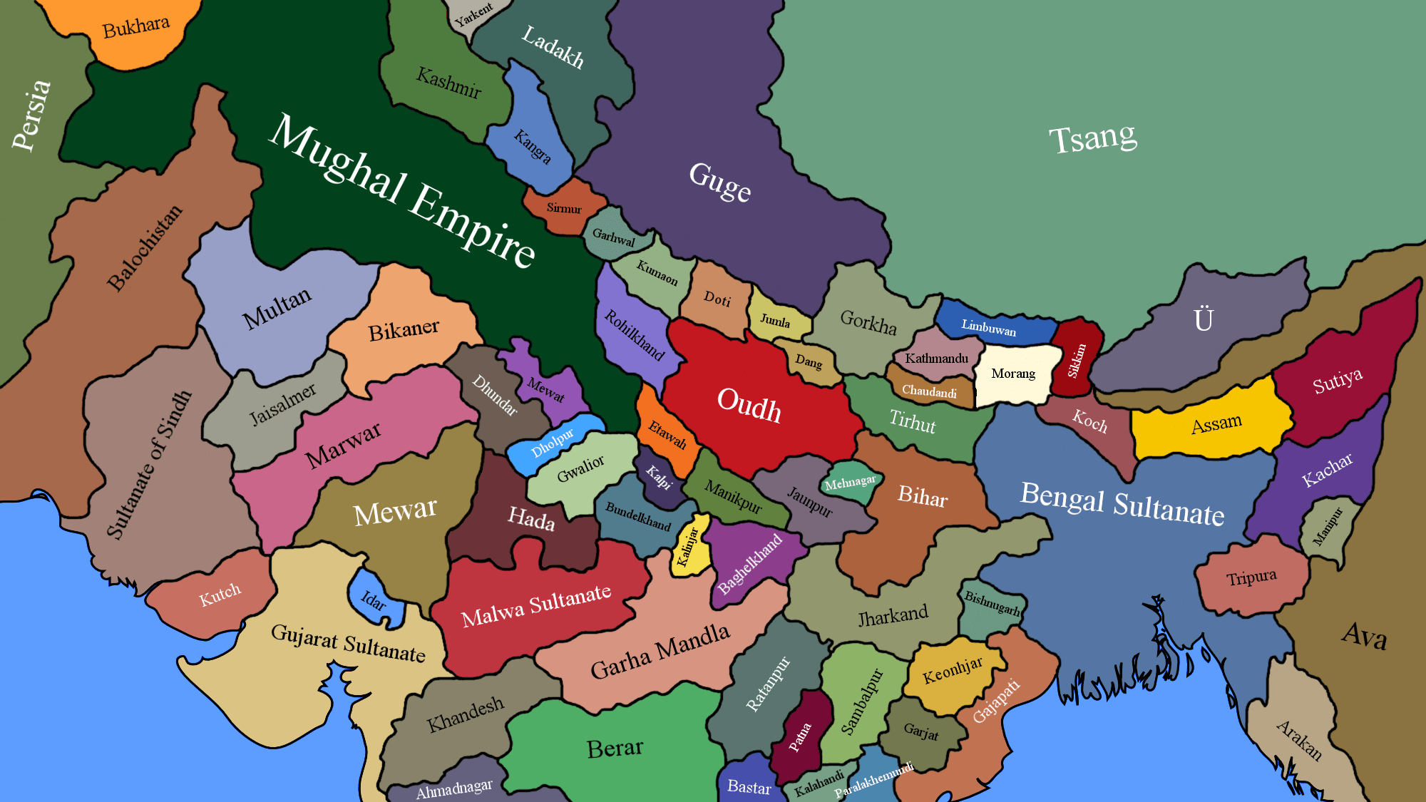
Image: India After the Battle of Panipat (1526)
Size of this preview: 800 × 450 pixels. Other resolutions: 320 × 180 pixels | 2,000 × 1,125 pixels.
Original image (2,000 × 1,125 pixels, file size: 193 KB, MIME type: image/png)
Description: This is a political map of northern India after Babur defeated the Delhi Sultanate of Ibrahim Lodi in the First Battle of Panipat (1526). The aftermath of this battle led to the fragmentation of the eastern Gangetic Plain into various Afghan/Purbia-led kingdoms, and the confederation of Rajasthan under Rana Sanga of Mewar.
Title: India After the Battle of Panipat (1526)
Credit: Own work
Author: Shahanshah26
Usage Terms: Creative Commons Attribution-Share Alike 4.0
License: CC BY-SA 4.0
License Link: https://creativecommons.org/licenses/by-sa/4.0
Attribution Required?: Yes
Image usage
The following page links to this image:

All content from Kiddle encyclopedia articles (including the article images and facts) can be freely used under Attribution-ShareAlike license, unless stated otherwise.
.png)