
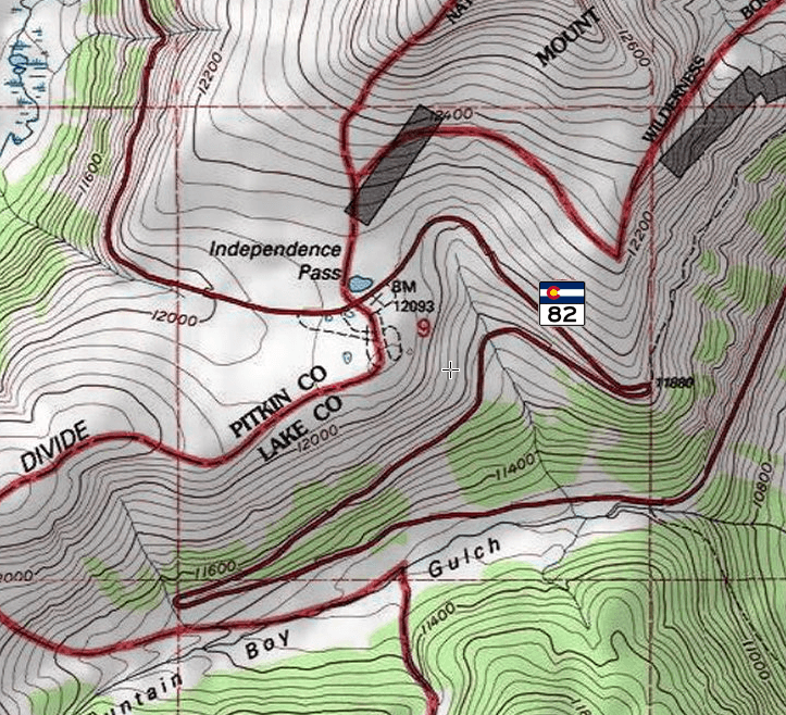
Image: Independence Pass USGS map
Size of this preview: 659 × 600 pixels. Other resolutions: 264 × 240 pixels | 723 × 658 pixels.
Original image (723 × 658 pixels, file size: 996 KB, MIME type: image/png)
Description: USGS map of Independence Pass,
Title: Independence Pass USGS map
Credit: USGS Independence Pass 7 -minute quadrangle as depicted here at the ACME Mapper site
Author: Cartographer unknown. Colorado State Highway 82 shield added by Daniel Case
Usage Terms: Public domain
License: Public domain
Attribution Required?: No
Image usage
The following page links to this image:

All content from Kiddle encyclopedia articles (including the article images and facts) can be freely used under Attribution-ShareAlike license, unless stated otherwise.