
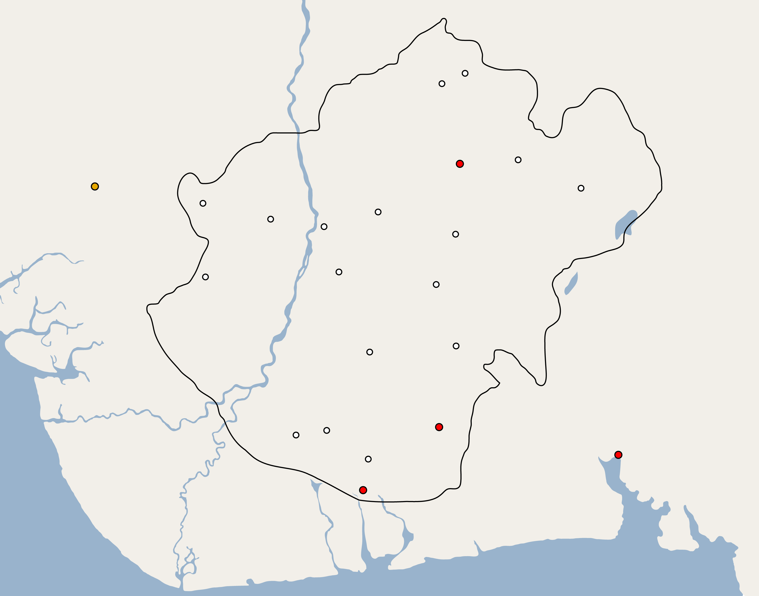
Image: Igboland
Size of this preview: 763 × 599 pixels. Other resolutions: 306 × 240 pixels | 2,933 × 2,304 pixels.
Original image (2,933 × 2,304 pixels, file size: 79 KB, MIME type: image/png)
Description: The map of the indigenous territory of the Igbo people of southeastern Nigeria.
Title: Igboland
Credit: Monteath, Archibald (2007) Archibald Monteath: Igbo, Jamaican, Moravian, University of West Indies Press, p. 26 ISBN: 9-766-40197-7.
Author: Ukabia (talk)
Usage Terms: Creative Commons Attribution-Share Alike 3.0
License: CC BY-SA 3.0
License Link: https://creativecommons.org/licenses/by-sa/3.0
Attribution Required?: Yes
Image usage
The following 2 pages link to this image:

All content from Kiddle encyclopedia articles (including the article images and facts) can be freely used under Attribution-ShareAlike license, unless stated otherwise.