
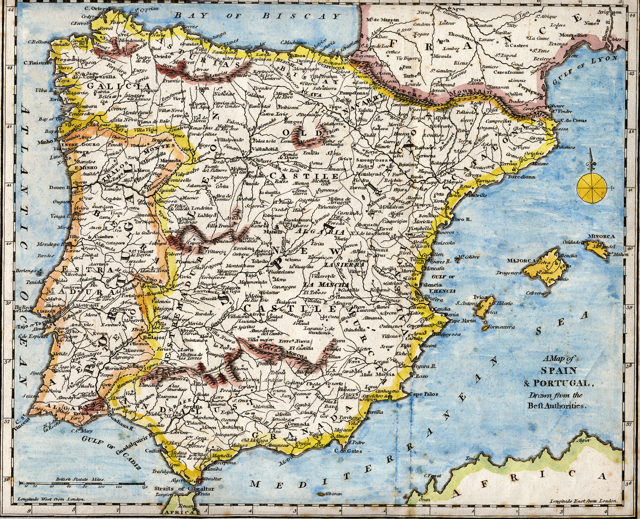
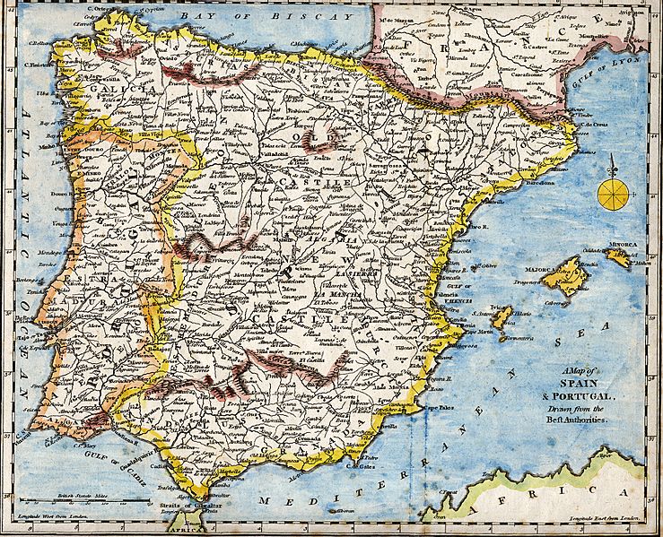
Image: Iberian Peninsula antique map
Size of this preview: 739 × 599 pixels. Other resolutions: 296 × 240 pixels | 2,096 × 1,700 pixels.
Original image (2,096 × 1,700 pixels, file size: 5.81 MB, MIME type: image/jpeg)
Description: 18th century hand-coloured engraved map of the Iberian peninsula depicting various topographical features of the land, as published in Robert Wilkinson's General Atlas, circa 1794. (Volume 2., page 666.) Titl'd A Map of Spain & Portugal, Drawn from the Beſt Authorities
Title: Iberian Peninsula antique map
Credit: Scanned from my personal collection. (scanned by User:RedCoat)
Author: Robert Wilkinson
Usage Terms: Public domain
License: Public domain
Attribution Required?: No
Image usage
The following 3 pages link to this image:

All content from Kiddle encyclopedia articles (including the article images and facts) can be freely used under Attribution-ShareAlike license, unless stated otherwise.