
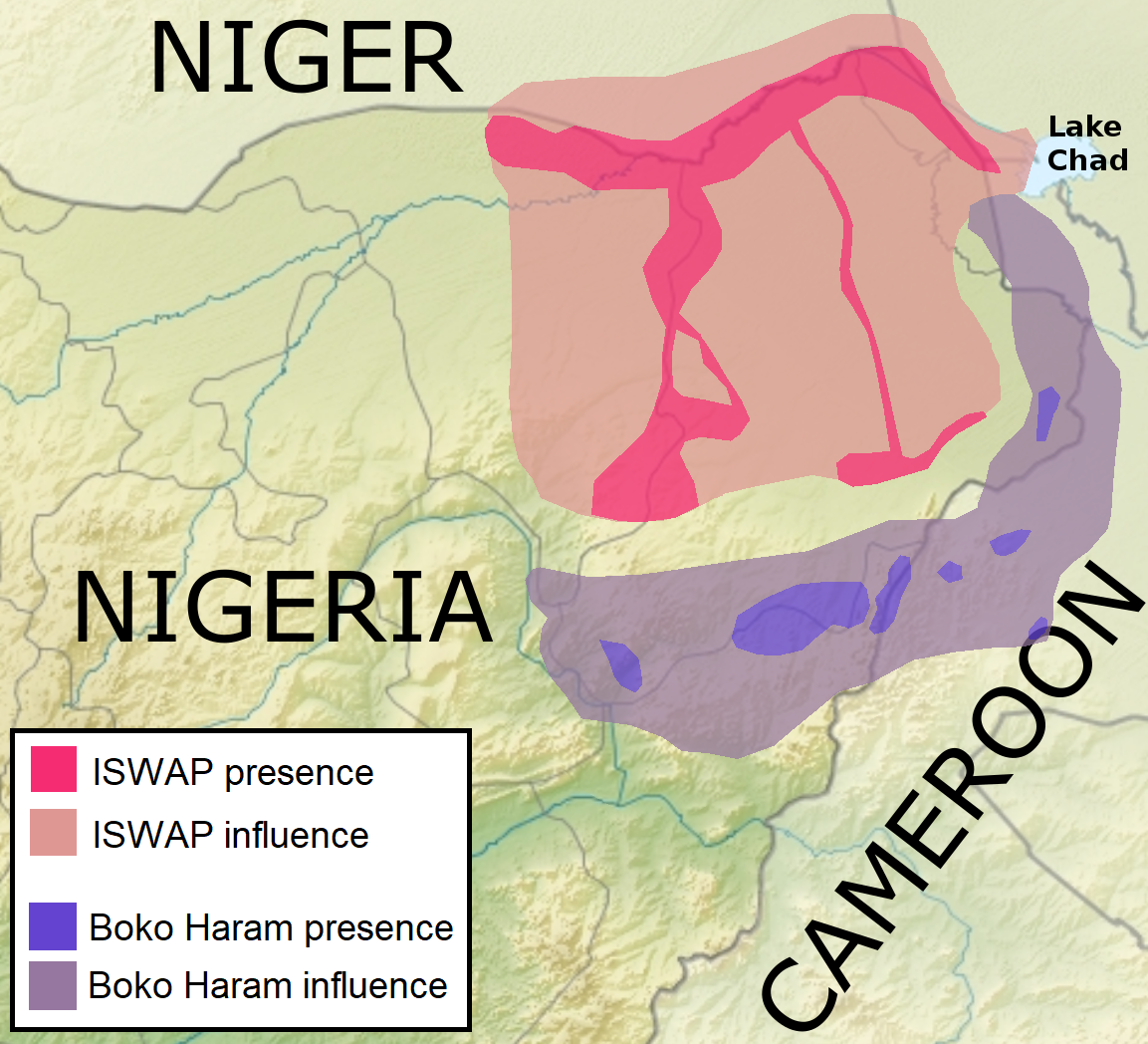
Image: ISWAP and Boko Haram territory in early 2019
Size of this preview: 660 × 600 pixels. Other resolutions: 264 × 240 pixels | 1,153 × 1,048 pixels.
Original image (1,153 × 1,048 pixels, file size: 414 KB, MIME type: image/png)
Description: Dark pink: Approximate presence of ISWAP (Islamic State's West Africa Province) Light pink: Approximate influence of ISWAP Dark violet: Approximate presence of Boko Haram (Abubakar Shekau's forces) Light violet: Approximate influence of Boko Haram Source: Islamic State, Seeking Next Chapter, Makes Inroads Through West Africa
Title: ISWAP and Boko Haram territory in early 2019
Credit: Own work This file was derived from: Nigeria relief location map.jpg
Author: Applodion Borysk5
Usage Terms: Creative Commons Attribution-Share Alike 4.0
License: CC BY-SA 4.0
License Link: https://creativecommons.org/licenses/by-sa/4.0
Attribution Required?: Yes
Image usage
The following 2 pages link to this image:

All content from Kiddle encyclopedia articles (including the article images and facts) can be freely used under Attribution-ShareAlike license, unless stated otherwise.