
Image: ICE bridge Antarctic Sea Ice

Size of this preview: 800 × 533 pixels. Other resolutions: 320 × 213 pixels | 1,942 × 1,295 pixels.
Original image (1,942 × 1,295 pixels, file size: 604 KB, MIME type: image/jpeg)
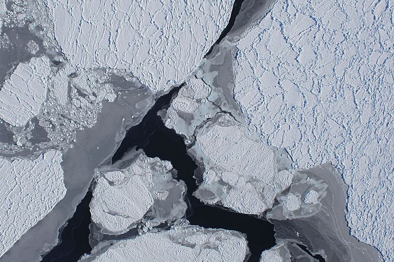
Description: The first flight of Operation Ice Bridge’s Antarctic campaign flew Oct. 16, 2009, along the Amundsen Coast. The aircraft’s downward-looking Digital Mapping System camera captured images of sea ice from an altitude of at least 20,000 feet.
Usage Terms: Public domain
Image usage
The following page links to this image:

All content from Kiddle encyclopedia articles (including the article images and facts) can be freely used under Attribution-ShareAlike license, unless stated otherwise.