Image: I-49 map 2014

Size of this PNG preview of this SVG file: 509 × 299 pixels. Other resolution: 320 × 188 pixels.
Original image (SVG file, nominally 509 × 299 pixels, file size: 403 KB)
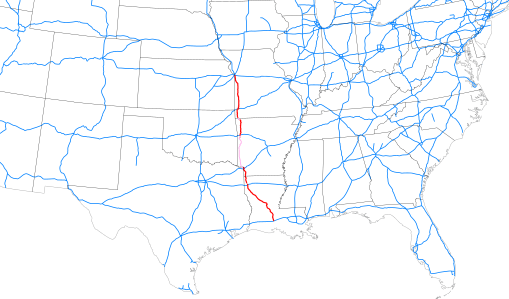
Description: Map of Interstate 49 as of 2014-12-31 highlighted in red, overall location within southeastern United States.
Title: I-49 map 2014
Credit: Map based on File:Map of current Interstates.svg (Public domain) modified to include recent Interstate additions, route of I-49 georeferenced from KML file in article This W3C-unspecified vector image was created with Inkscape.
Author: Mr. Matté (if there is an issue with this image, contact me using this image's Commons talk page or my English Wikipedia talk page; I'll know about it a lot faster)
Usage Terms: Public domain
License: Public domain
Attribution Required?: No
Image usage
The following page links to this image:

All content from Kiddle encyclopedia articles (including the article images and facts) can be freely used under Attribution-ShareAlike license, unless stated otherwise.
