Image: Hurricane javier 2004

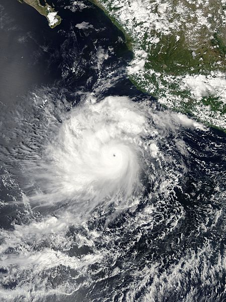
Description: The MODIS instrument flying aboard NASA's Aqua satellite captured this true-color image of Hurricane Javier on September 13, 2004 at 20:40 UTC (4:40 PM EDT). At the time this image was taken Javier was located approximately 982 km (610 miles) southeast of Cabo San Lucas, Mexico and was moving towards the northwest at 15 km/hr (9 mph). Maximum sustained winds were near 222 km/hr (138 mph) with higher gusts to 269 km/hr (167 mph).
Title: Hurricane javier 2004
Credit: http://earthobservatory.nasa.gov/NaturalHazards/natural_hazards_v2.php3?img_id=12435
Author: NASA image created by Jesse Allen, Earth Observatory, from data provided by the MODIS Rapid Response team.
Permission: This file is in the public domain in the United States because it was solely created by NASA. NASA copyright policy states that "NASA material is not protected by copyright unless noted". (See Template:PD-USGov, NASA copyright policy page or JPL Image Use Policy.) Warnings: Use of NASA logos, insignia and emblems is restricted per U.S. law 14 CFR 1221. The NASA website hosts a large number of images from the Soviet/Russian space agency, and other non-American space agencies. These are not necessarily in the public domain. Materials based on Hubble Space Telescope data may be copyrighted if they are not explicitly produced by the STScI.[1] See also and Template:Cc-Hubble. The SOHO (ESA & NASA) joint project implies that all materials created by its probe are copyrighted and require permission for commercial non-educational use. [2] Images featured on the Astronomy Picture of the Day (APOD) web site may be copyrighted. [3] The National Space Science Data Center (NSSDC) site has been known to host copyrighted content even though its photo gallery FAQ states that all of the images in the photo gallery are in the public domain.
Usage Terms: Public domain
License: Public domain
Attribution Required?: No
Image usage
The following page links to this image:

