
Image: Hudson Valley Map Detail Nova Belgica Et Anglia Nova c1634
Size of this preview: 800 × 481 pixels. Other resolutions: 320 × 192 pixels | 2,755 × 1,655 pixels.
Original image (2,755 × 1,655 pixels, file size: 1.77 MB, MIME type: image/jpeg)
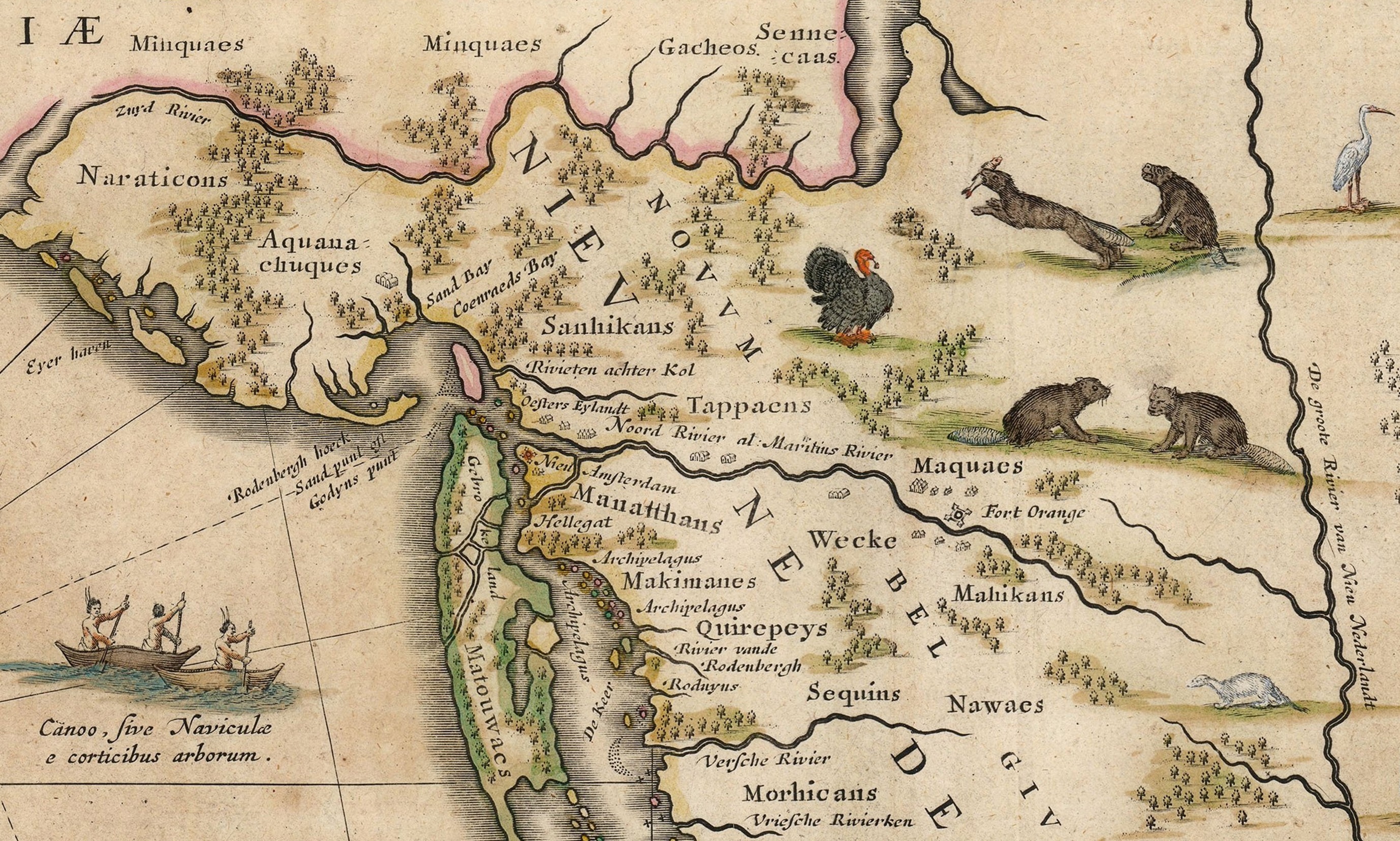
Description: Map detail of the Hudson Valley (aka Hudson River Valley) and surrounding area. Image cropped from Nova Belgica Et Anglia Nova (New Netherland and New England). Made by Willem Jansz. Blaeu (1571-1638). It is based on cartography of Adriaen Block (1567-1627) and Dutch fur traders in the 17th century. Note: the right side is north.
Title: Hudson Valley Map Detail Nova Belgica Et Anglia Nova c1634
Credit: Image cropped from: Nova Belgica Et Anglia Nova (New Netherland and New England) Blaeu Map c1634.jpg
Author: Willem Blaeu
Usage Terms: Public domain
License: Public domain
Attribution Required?: No
Image usage
The following 2 pages link to this image:

All content from Kiddle encyclopedia articles (including the article images and facts) can be freely used under Attribution-ShareAlike license, unless stated otherwise.