
Image: Horsethatleaps Map1 wikipedia
Size of this preview: 800 × 589 pixels. Other resolutions: 320 × 236 pixels | 1,000 × 736 pixels.
Original image (1,000 × 736 pixels, file size: 387 KB, MIME type: image/jpeg)
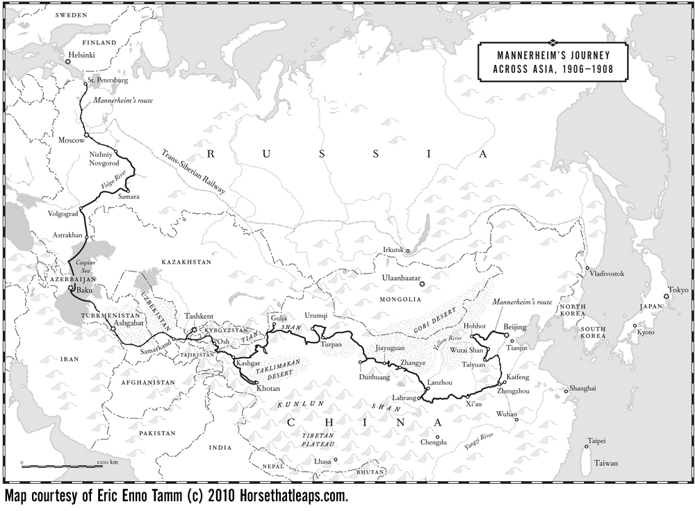
Description: Map of Gustaf Mannerheim's expedition across Asia first published in "The Horse That Leaps Through Clouds: A Tale of Espionage, the Silk Road and the Rise of Modern China," by Eric Enno Tamm, 2010, see Horsethatleaps.com
Usage Terms: Public domain
Image usage
The following page links to this image:

All content from Kiddle encyclopedia articles (including the article images and facts) can be freely used under Attribution-ShareAlike license, unless stated otherwise.