
Image: Hobson's-brook-Vicar's-brook=
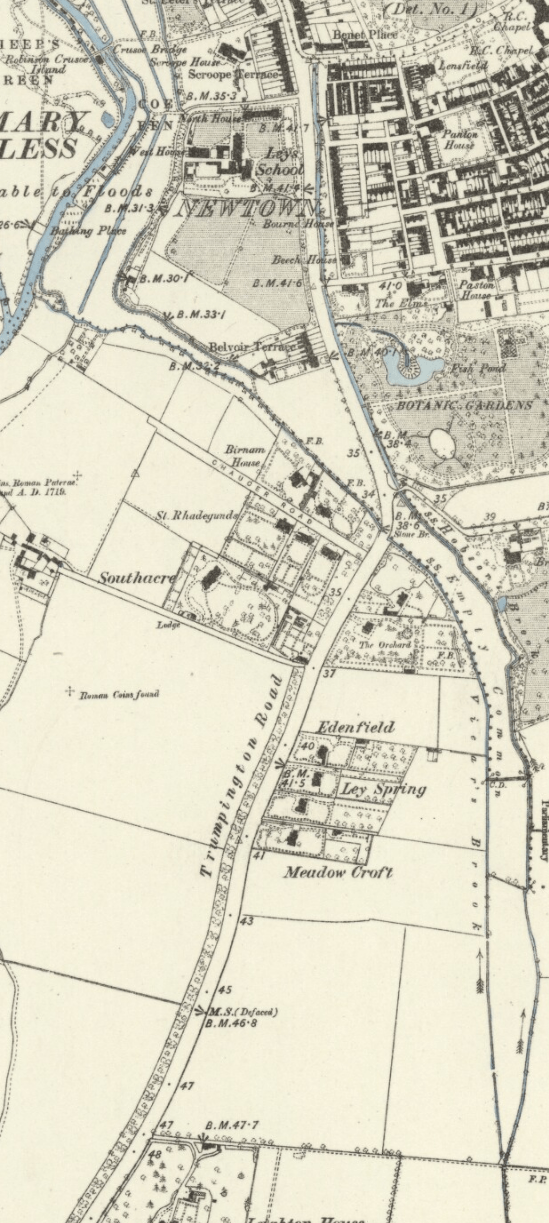
Description: Detail of 1886 Ordnance Survey Map of Cambridgeshire, showing the overground portion of Hobson's Brook between its branching from Vicar's Brook and entering the conduit head at Lensfield Road
Title: Hobson's-brook-Vicar's-brook=
Credit: Cambridgeshire XLVII.NW. online archive of National Library of Scotland
Author: Ordnance Survey
Permission: This file is in the public domain because its copyright has expired in the United States and those countries with a copyright term of no more than the life of the author plus 100 years. Public domain //en.wikipedia.org/wiki/File:Hobson%27s-brook-Vicar%27s-brook%3D.png
Usage Terms: Public domain
License: Public domain
License Link: //en.wikipedia.org/wiki/File:Hobson%27s-brook-Vicar%27s-brook%3D.png
Image usage
The following page links to this image:
