
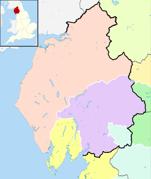
Image: Historic counties within Cumbria

Description: Map showing the historic counties within the present-day ceremonial county of Cumbria, England. Equirectangular map projection on WGS 84 datum, with N/S stretched 170% Geographic limits: West: 3.80°W East: 2.10°W North: 55.20°N South: 54.02°N Key Ceremonial county boundaries since 1974 Cumbria Other counties Historic counties Cumberland Westmorland Lancashire West Riding of Yorkshire North Riding of Yorkshire County Durham Northumberland
Title: Historic counties within Cumbria
Credit: This file was derived from: Cumbria UK parish map (blank).svg: Durham UK parish map (blank).svg: Lancashire UK parish map (blank).svg: North Yorkshire UK parish map (blank).svg: English geographical counties 1965 with ridings.svg:
Author: Cumbria_UK_parish_map_(blank).svg, Durham_UK_parish_map_(blank).svg, Lancashire_UK_parish_map_(blank).svg, North_Yorkshire_UK_parish_map_(blank).svg: Nilfanion. Contains Ordnance Survey data © Crown copyright and database right. English_geographical_counties_1965_with_ridings.svg: Nilfanion, XrysD and Dr Greg derivative work: Dr Greg
Usage Terms: Creative Commons Attribution-Share Alike 4.0
License: CC BY-SA 4.0
License Link: https://creativecommons.org/licenses/by-sa/4.0
Attribution Required?: Yes
Image usage
The following 2 pages link to this image:
