Image: Historic Places St. Bernard

Size of this preview: 800 × 518 pixels. Other resolutions: 320 × 207 pixels | 3,400 × 2,200 pixels.
Original image (3,400 × 2,200 pixels, file size: 1.91 MB, MIME type: image/jpeg)
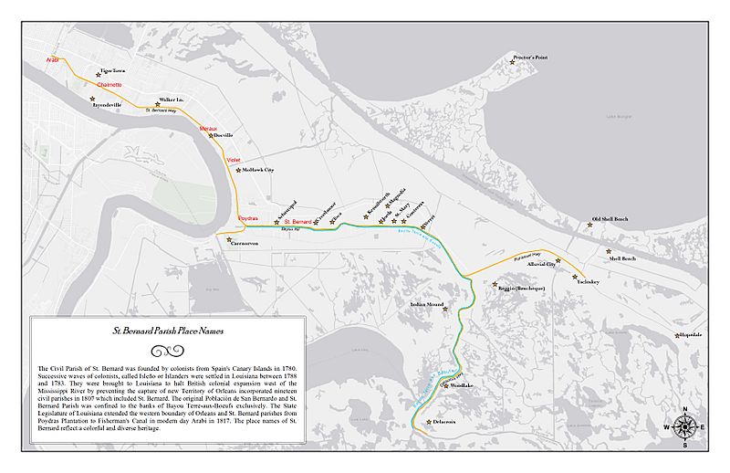
Description: This map was created from an oral history interview of Philip Acosta. Phillip wanted to create a map for display in the Islenos museum to display old community names in Lower St Bernard Parish. Map shows distinct communities that have been merged into larger communities and the historical names associated with the areas.
Title: Historic Places St. Bernard
Credit: Own work[1]
Author: Rclipper
Usage Terms: Creative Commons Attribution-Share Alike 4.0
License: CC BY-SA 4.0
License Link: https://creativecommons.org/licenses/by-sa/4.0
Attribution Required?: Yes
Image usage
The following page links to this image:

All content from Kiddle encyclopedia articles (including the article images and facts) can be freely used under Attribution-ShareAlike license, unless stated otherwise.
