
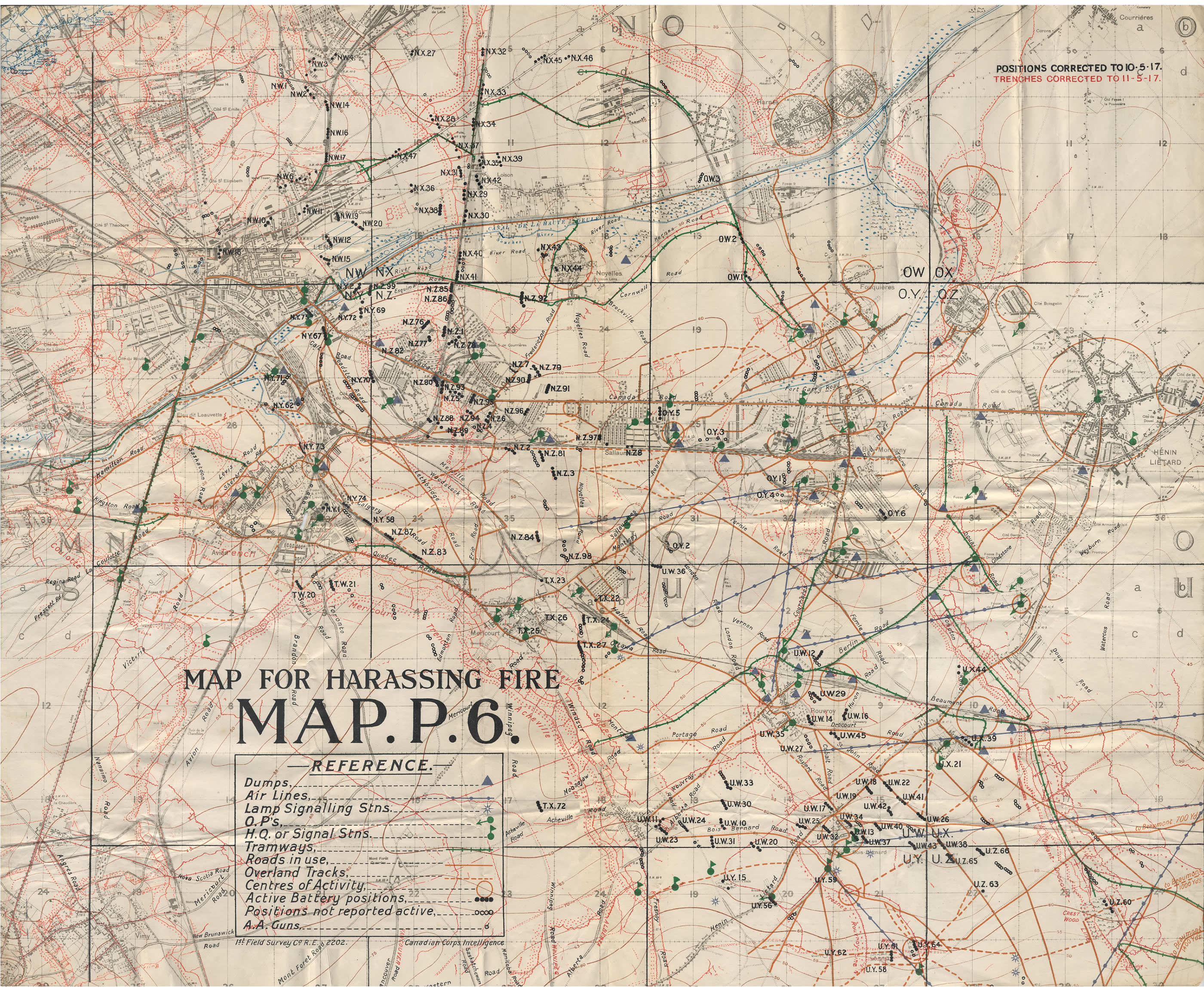
Image: Hill 70 - Map of harassing fire
Size of this preview: 732 × 600 pixels. Other resolutions: 293 × 240 pixels | 2,800 × 2,295 pixels.
Original image (2,800 × 2,295 pixels, file size: 1.45 MB, MIME type: image/jpeg)
Description: Artillery map for the Lens area, 11 May 1917. The German trenches, indicated in red, would have been targets in preparation for the battle at Hill 70 in August 1917.
Title: Hill 70 - Map of harassing fire
Credit: Canadian War Museum
Author: Canada. Dept. of National Defence, 1st Field Survey Company, Royal Engineers
Usage Terms: Public domain
License: Public domain
Attribution Required?: No
Image usage
The following page links to this image:

All content from Kiddle encyclopedia articles (including the article images and facts) can be freely used under Attribution-ShareAlike license, unless stated otherwise.