
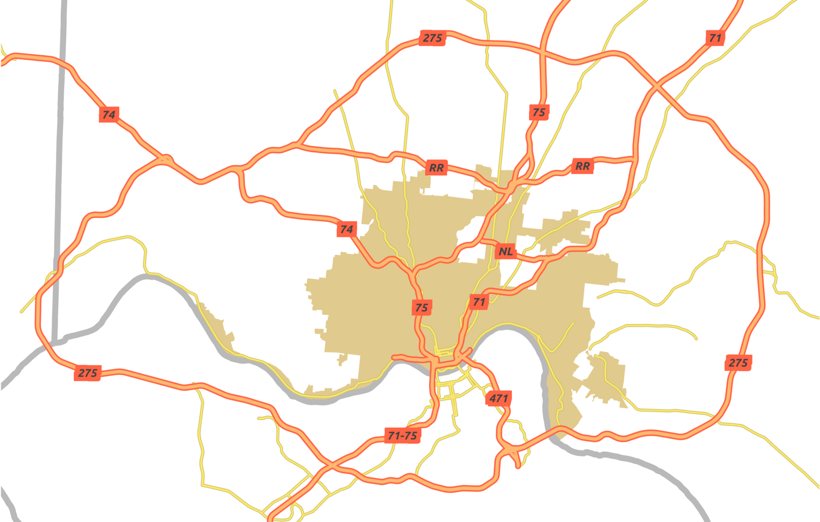
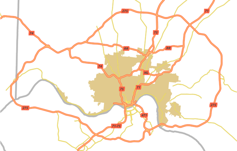
Image: Highways of Greater Cincinnati
Size of this preview: 800 × 509 pixels. Other resolutions: 320 × 204 pixels | 3,300 × 2,100 pixels.
Original image (3,300 × 2,100 pixels, file size: 874 KB, MIME type: image/png)
Description: A map of highways and major artierials in the Greater Cincinnati area.
Title: Highways of Greater Cincinnati
Credit: Openstreetmap data, 2012 US Census data
Author: Nate Wessel
Usage Terms: Creative Commons Attribution-Share Alike 3.0
License: CC BY-SA 3.0
License Link: http://creativecommons.org/licenses/by-sa/3.0
Attribution Required?: Yes
Image usage
The following 2 pages link to this image:

All content from Kiddle encyclopedia articles (including the article images and facts) can be freely used under Attribution-ShareAlike license, unless stated otherwise.