
Image: Harrisburgilmap1925
Size of this preview: 800 × 562 pixels. Other resolutions: 320 × 225 pixels | 1,600 × 1,124 pixels.
Original image (1,600 × 1,124 pixels, file size: 357 KB, MIME type: image/jpeg)
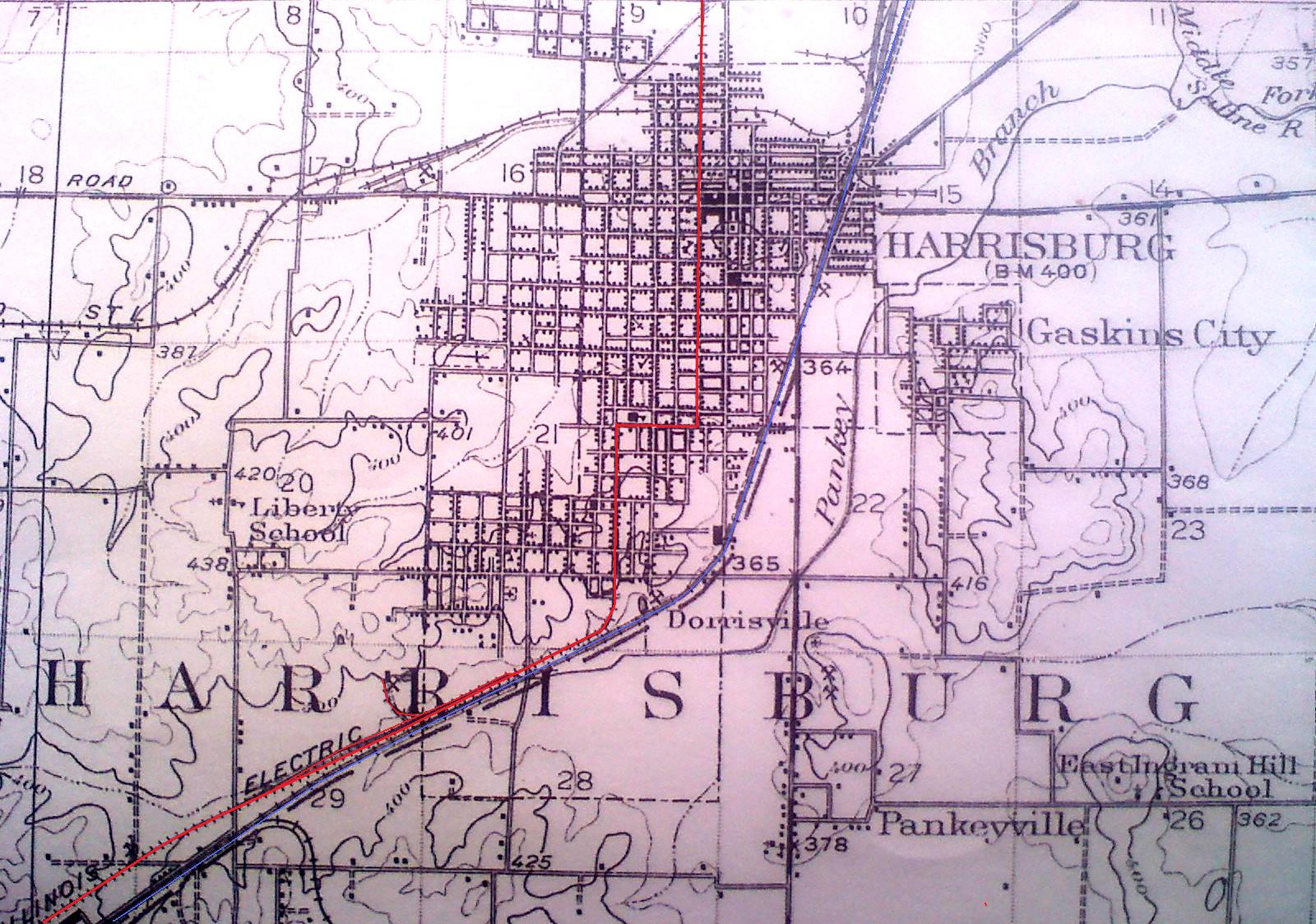
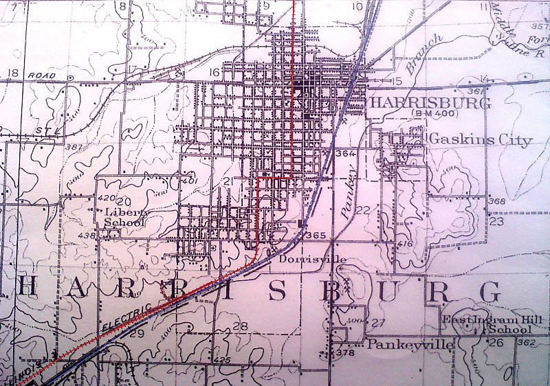
Description: Harrisburg, Illinois 1920 map; changes from original: CCC&STL railroad in blue. SIR&PCco. Interurban in red.
Title: Harrisburgilmap1925
Credit: Harrisburg Public Library
Author: USGS
Usage Terms: Public domain
License: PD
Attribution Required?: No
Image usage
The following page links to this image:

All content from Kiddle encyclopedia articles (including the article images and facts) can be freely used under Attribution-ShareAlike license, unless stated otherwise.