
Image: Hankow 1915
Size of this preview: 470 × 600 pixels. Other resolutions: 188 × 240 pixels | 1,598 × 2,039 pixels.
Original image (1,598 × 2,039 pixels, file size: 469 KB, MIME type: image/jpeg)
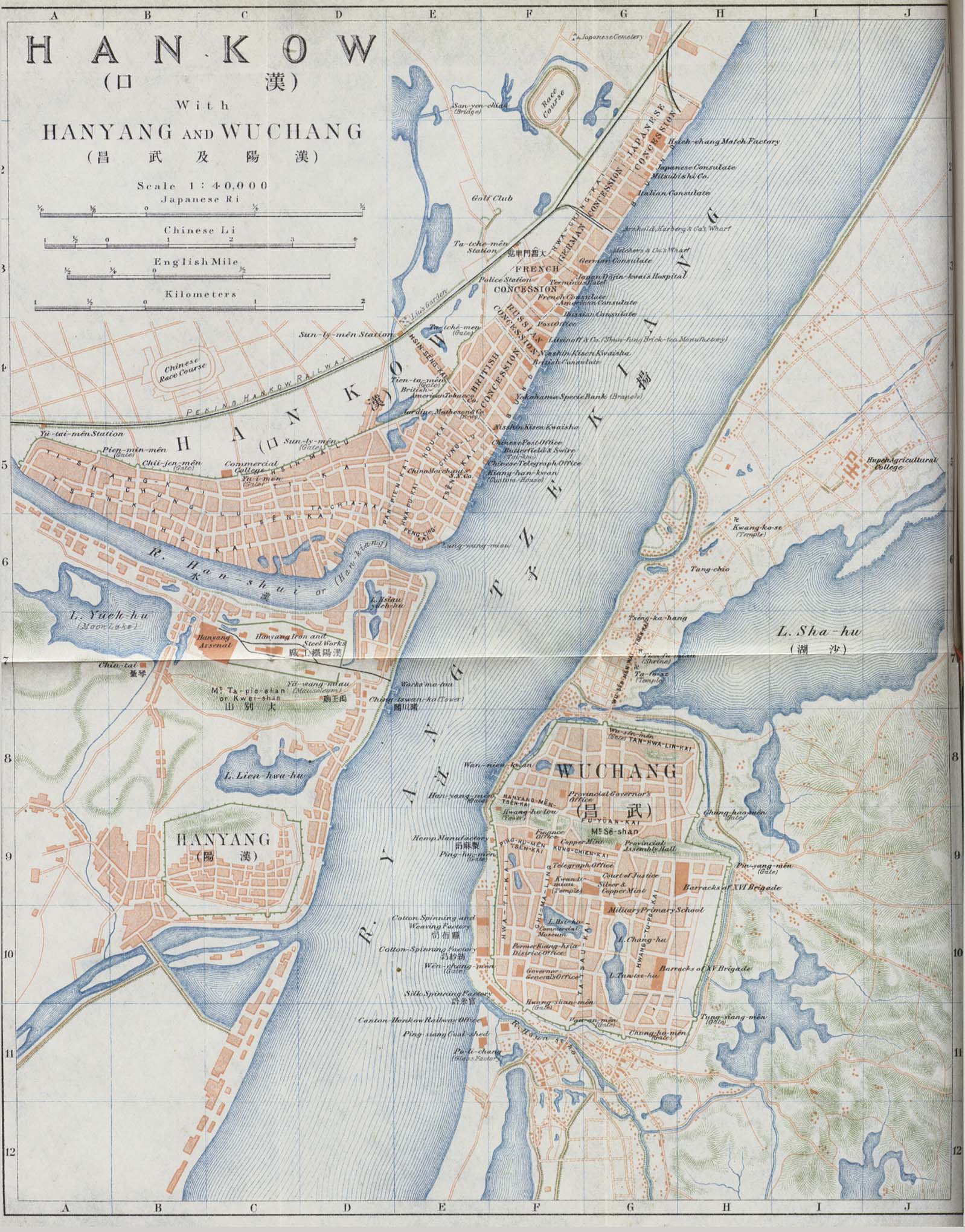
Description: Map of Hankow (Hankou, in Pinyin) with Hanyang and Wuchang, as of 1915. These three cities have later merged to form modern Wuhan. The map shows the borders of the French, British, Russian, German, and Japanese concessions in Hankou.
Title: Hankow 1915
Credit: http://www.lib.utexas.edu/maps/historical/hankow_1915.jpg , http://www.lib.utexas.edu/maps/historical/history_china.html
Author: Compilers of "An Offical Guide to Eastern Asia, Volume IV: China. Published by The Imperial Japanese Government Railways. Tokyo, 1915."
Usage Terms: Public domain
License: Public domain
Attribution Required?: No
Image usage
The following page links to this image:

All content from Kiddle encyclopedia articles (including the article images and facts) can be freely used under Attribution-ShareAlike license, unless stated otherwise.