
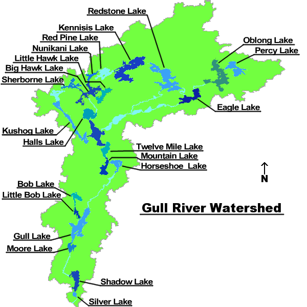
Image: Gull River watershed
No higher resolution available.
Gull_River_watershed.png (600 × 600 pixels, file size: 56 KB, MIME type: image/png)
Description: A map based upon a water level map on the Trent-Severn Waterways website labeling the lakes of the system.
Title: Gull River watershed
Credit: Own work This PNG graphic was created with GIMP.
Author: ʄɭoʏɗiaɲ τ¢
Usage Terms: Creative Commons Attribution-Share Alike 3.0
License: CC BY-SA 3.0
License Link: https://creativecommons.org/licenses/by-sa/3.0
Attribution Required?: Yes
Image usage
The following page links to this image:

All content from Kiddle encyclopedia articles (including the article images and facts) can be freely used under Attribution-ShareAlike license, unless stated otherwise.