Image: Grimball's Landing Battlefield South Carolina

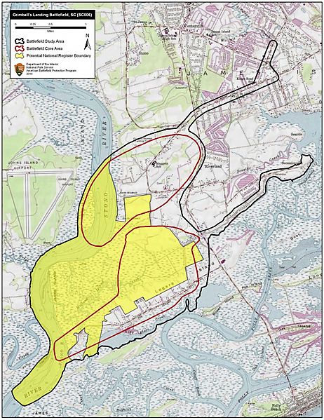
Description: Map of battlefield core and study areas. The ABPP extended the 1993 Study Area to include US naval maneuvers on the Stono River as well as the approach of US Army forces from Battery Island. The revised Study Area also includes the Confederate advance into battle from their camps beyond the Artillery Crossroads, and the locations of fortifications around Secessionville. The expanded Core Area now includes the fields of fire associated with US gunboats and armed transports near Stevens’ Landing, as well as the field of fire from the Federal battery located north of Holland Island Creek. The ABPP also added the location of skirmishing near the northern edge of the river's causeway to the Core Area.
Title: Grimball's Landing Battlefield South Carolina
Credit: National Park Service
Author: American Battlefield Protection Program
Usage Terms: Public domain
License: Public domain
Attribution Required?: No
Image usage
The following page links to this image:

