Image: GreysRaid

Size of this preview: 800 × 591 pixels. Other resolutions: 320 × 236 pixels | 3,648 × 2,695 pixels.
Original image (3,648 × 2,695 pixels, file size: 9.05 MB, MIME type: image/png)
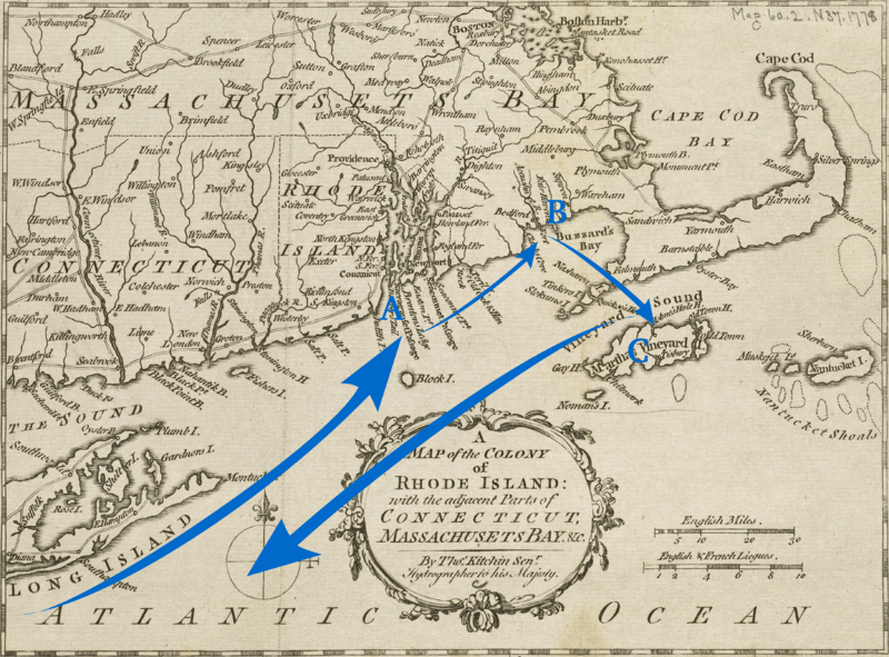
Description: A 1778 map annotated with the route of a raiding expedition against Massachusetts coastal communities in September 1778. The expedition was under the command of British General Charles Grey. Points of note: A: Newport, Rhode Island B: New Bedford and Fairhaven, Massachusetts C: Martha's Vineyard
Title: GreysRaid
Credit: Boston Public Library Online Maps Collection: http://maps.bpl.org/details_14154/
Author: base image: Thomas Kitchin; annotation: User:Magicpiano
Permission: public domain
Usage Terms: Public domain
License: Public domain
Attribution Required?: No
Image usage
The following 2 pages link to this image:

All content from Kiddle encyclopedia articles (including the article images and facts) can be freely used under Attribution-ShareAlike license, unless stated otherwise.
