
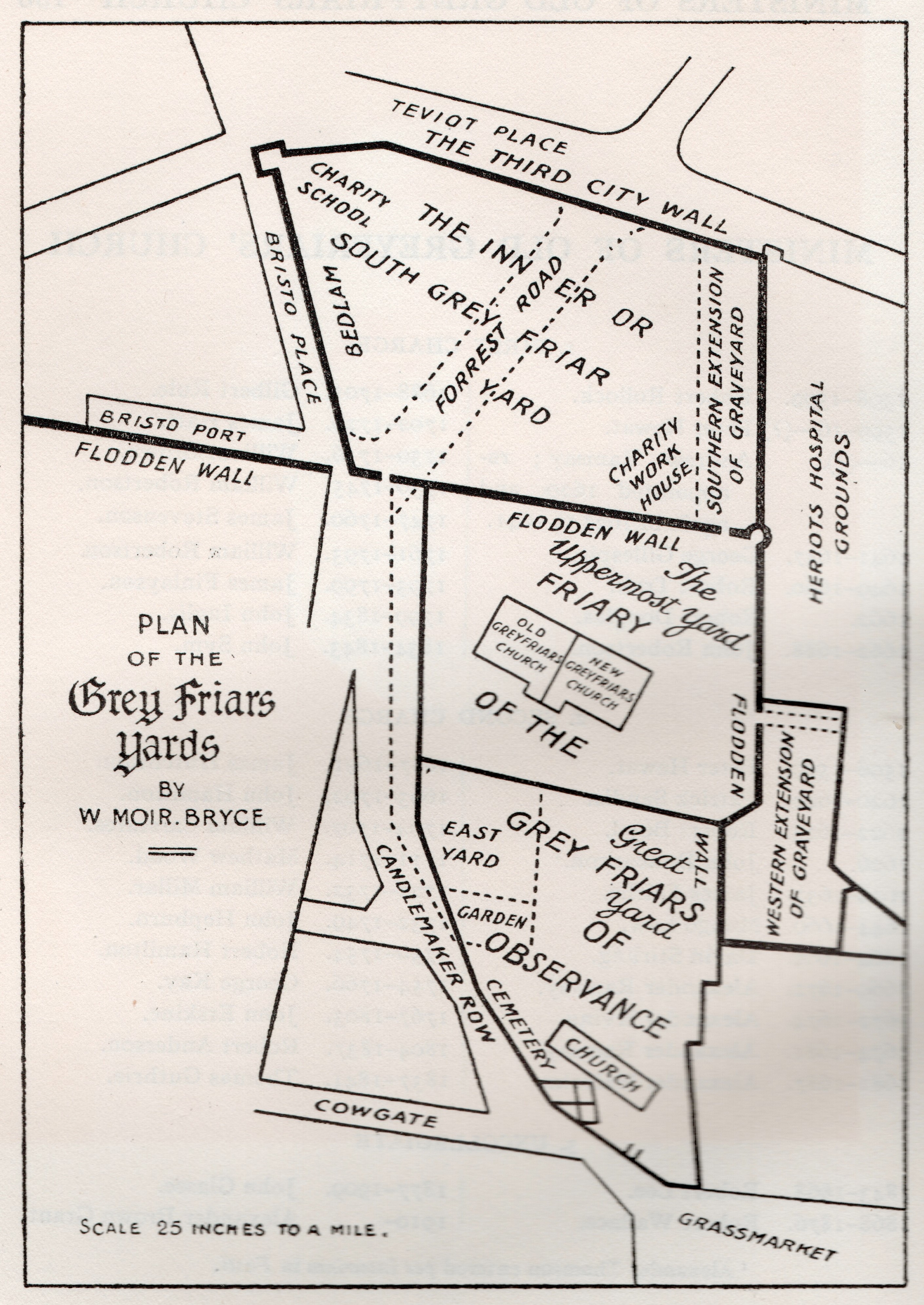
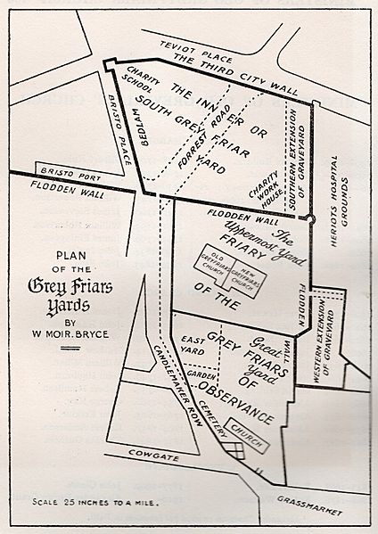
Image: Greyfriars Map
Size of this preview: 424 × 599 pixels. Other resolutions: 170 × 240 pixels | 2,820 × 3,982 pixels.
Original image (2,820 × 3,982 pixels, file size: 2.27 MB, MIME type: image/jpeg)
Description: Map by W. Moir Bryce showing the historical development of Greyfriars Kirk and Kirkyard, Edinburgh.
Title: Greyfriars Map
Credit: Bryce, W. Moir, 'Old Greyfriars' (1912)
Author: W. Moir Bryce
Usage Terms: Public domain
License: Public domain
Attribution Required?: No
Image usage
The following page links to this image:

All content from Kiddle encyclopedia articles (including the article images and facts) can be freely used under Attribution-ShareAlike license, unless stated otherwise.