
Image: Greyfriars 1647
No higher resolution available.
Greyfriars_1647.png (531 × 532 pixels, file size: 264 KB, MIME type: image/png)
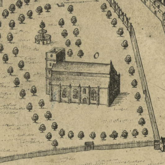
Description: A detail of James Gordon of Rothiemay's 1647 map of Edinburgh, showing Greyfriars Kirk. This is the only depiction of the church before an explosion of 1718 destroyed the west tower. The church was subsequently restored and extended.
Title: Greyfriars 1647
Credit: https://maps.nls.uk/view/74475427
Author: James Gordon of Rothiemay (c. 1615-1687)
Usage Terms: Public domain
License: Public domain
Attribution Required?: No
Image usage
The following page links to this image:

All content from Kiddle encyclopedia articles (including the article images and facts) can be freely used under Attribution-ShareAlike license, unless stated otherwise.