
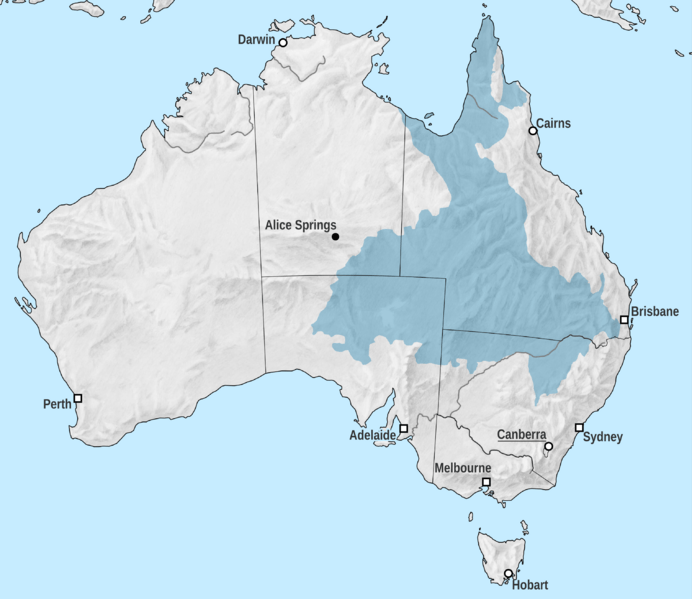
Image: Great Artesian Basin

Size of this preview: 692 × 599 pixels. Other resolutions: 277 × 240 pixels | 3,037 × 2,631 pixels.
Original image (3,037 × 2,631 pixels, file size: 2.38 MB, MIME type: image/png)
Description: Map of the Great Artesian Basin in Australia. Map projection: Lambert conformal conic, standard latitudes 18°S and 36°S, centred on 136°E and 24°S Map extents: -2200km to 2000km east-west, -3000km to 900km north-south
Title: Great Artesian Basin
Credit: Basin extent: Geoscience Australia Revised Great Artesian Basin Jurassic-Cretaceous boundary Coastline, rivers, state borders: Natural Earth dataset, 1:50M Shaded relief: Kenneth Townsend, Shaded Relief Archive
Author: Tentotwo
Usage Terms: Creative Commons Attribution-Share Alike 3.0
License: CC BY-SA 3.0
License Link: http://creativecommons.org/licenses/by-sa/3.0
Attribution Required?: Yes
Image usage
The following 3 pages link to this image:

All content from Kiddle encyclopedia articles (including the article images and facts) can be freely used under Attribution-ShareAlike license, unless stated otherwise.