
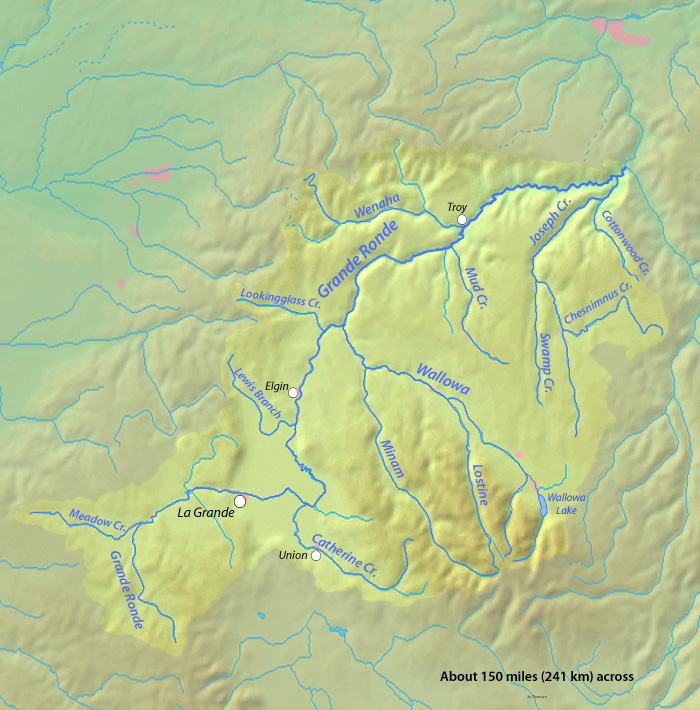
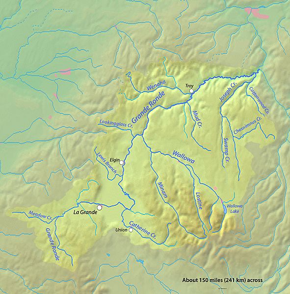
Image: Granderonderivermap
Size of this preview: 591 × 599 pixels. Other resolutions: 237 × 240 pixels | 700 × 710 pixels.
Original image (700 × 710 pixels, file size: 249 KB, MIME type: image/jpeg)
Description: Map of the Grande Ronde River in eastern Oregon, USA
Title: Granderonderivermap
Credit: Background topography from DEMIS Mapserver, which is public domain
Author: Shannon1
Usage Terms: Creative Commons Attribution-Share Alike 4.0
License: CC BY-SA 4.0
License Link: https://creativecommons.org/licenses/by-sa/4.0
Attribution Required?: Yes
Image usage
The following page links to this image:

All content from Kiddle encyclopedia articles (including the article images and facts) can be freely used under Attribution-ShareAlike license, unless stated otherwise.