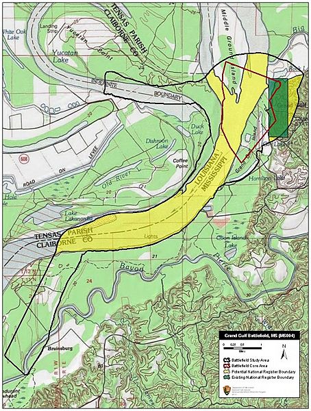
Image: Grand Gulf Battlefield Mississippi

Description: Map of battlefield core and study areas. The Study Area was modified to reflect the historic boundaries of the Mississippi River, which was used by Federal forces to approach Grand Gulf, and to include the landing site of the Federal XIII Corps at Hard Times Plantation. The Core Area was adjusted to conform to the historic boundaries of the Mississippi River, and was extended to include the maximum range of the guns involved in the bombardment of Grand Gulf’s two forts – Fort Cobun in the north and Fort Ward in the south – by Federal Naval forces from the water.
Title: Grand Gulf Battlefield Mississippi
Credit: National Park Service
Author: American Battlefield Protection Program
Usage Terms: Public domain
License: Public domain
Attribution Required?: No
Image usage
The following page links to this image:

