
Image: GrandPre1704RaidFirst
Size of this preview: 780 × 599 pixels. Other resolutions: 313 × 240 pixels | 1,200 × 922 pixels.
Original image (1,200 × 922 pixels, file size: 699 KB, MIME type: image/jpeg)
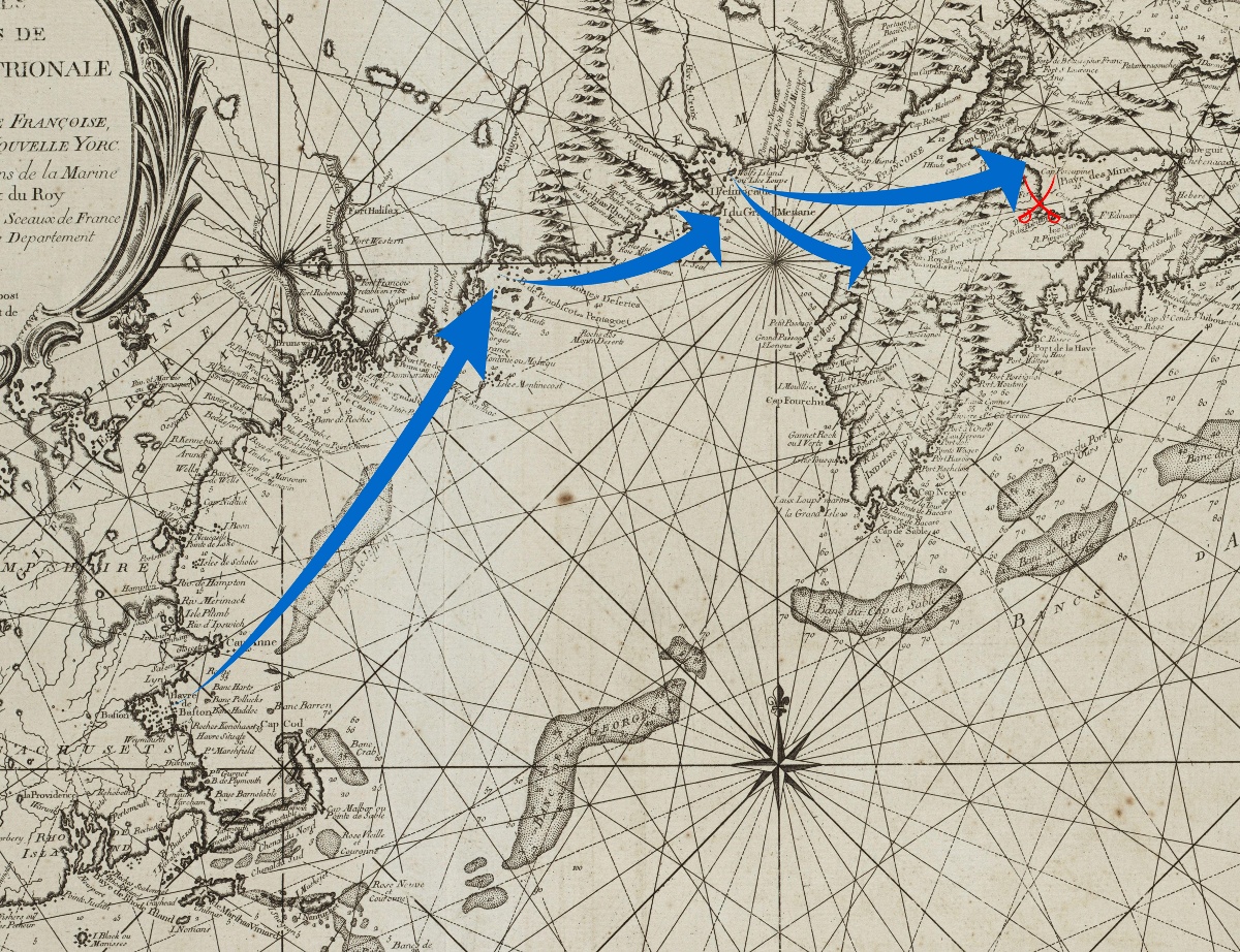
Description: Detail from an 18th century map annotated to show the movements of Benjamin Church's 1704 expedition against French Acadia, up to the Raid on Grand Pré (swords in red).
Title: GrandPre1704RaidFirst
Credit: Base map: Boston Public Library Map Collection: http://maps.bpl.org/details_10067/?mtid=756 Annotations: Own work
Author: Base map: Jacques Bellin; Annotations: User:Magicpiano
Usage Terms: Public domain
License: Public domain
Attribution Required?: No
Image usage
The following page links to this image:

All content from Kiddle encyclopedia articles (including the article images and facts) can be freely used under Attribution-ShareAlike license, unless stated otherwise.