
Image: Goodrich's Landing Battlefield Louisiana
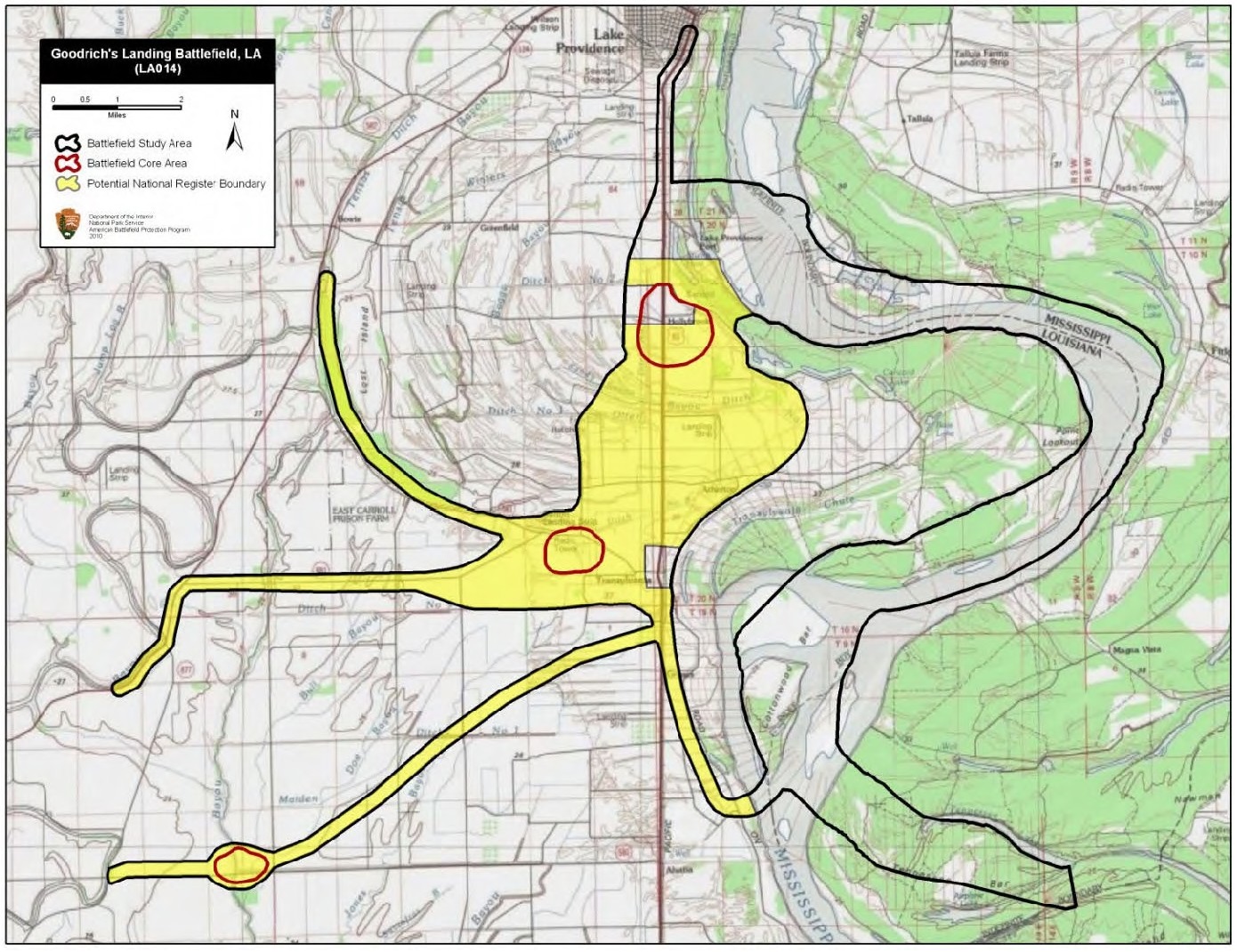
Description: Map of battlefield core and study areas. The ABPP significantly revised the CWSAC’s 1993 battlefield boundaries. The location of Goodrich’s Landing was found to be further south than originally thought in 1993 and the Study Area was revised accordingly. The Study Area was also expanded to include the Mississippi Marine Brigade’s line of march from Young's Point to intercept Parson’s retreating Confederates. An additional Core Area at Bayou Tensas was drawn to represent the Confederate rearguard action on June 30.
Title: Goodrich's Landing Battlefield Louisiana
Credit: National Park Service
Author: American Battlefield Protection Program
Usage Terms: Public domain
License: Public domain
Attribution Required?: No
Image usage
The following page links to this image:
