
Image: Golfe Saint-Laurent Depths fr

Size of this PNG preview of this SVG file: 627 × 599 pixels. Other resolution: 251 × 240 pixels.
Original image (SVG file, nominally 1,655 × 1,582 pixels, file size: 3.05 MB)
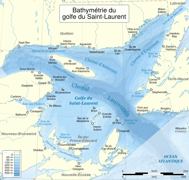
Description: Depths/bathymetry of the Saint Lawrence Gulf. Cartographic data : Lambert azimuthal equal-area projection Central longitude : -61.75 Central latitude : 48.5 Limits of the map : N 52, W -67, S 45, E -56.5 Scale : 1:2745000
Title: Golfe Saint-Laurent Depths fr
Credit: Source : Bathymetry & relief : SRTM30 Plus Shorelines, rivers & borders : NGDC GSHHS
Author: First version: Ewan ar Born Current version: Sémhur (talk)
Usage Terms: Creative Commons Attribution-Share Alike 3.0
License: CC BY-SA 3.0
License Link: https://creativecommons.org/licenses/by-sa/3.0
Attribution Required?: Yes
Image usage
The following page links to this image:

All content from Kiddle encyclopedia articles (including the article images and facts) can be freely used under Attribution-ShareAlike license, unless stated otherwise.