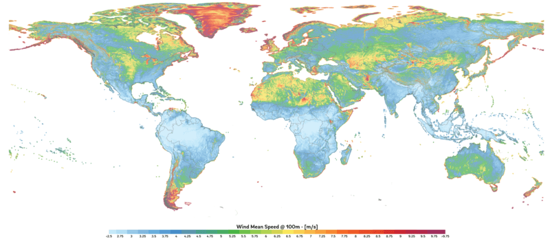
Image: Global Map of Wind Speed

Size of this preview: 800 × 351 pixels. Other resolutions: 320 × 140 pixels | 2,488 × 1,092 pixels.
Original image (2,488 × 1,092 pixels, file size: 1.91 MB, MIME type: image/png)
Description: This map provides an estimated summary of wind speed at 100 m above surface level. The map is derived from high-resolution wind speed distributions based on a chain of models, which downscales winds from global models (~70 km), to mesoscale (9 km) to microscale (150 m terrain). The output resolution is 1 km.
Title: Global Map of Wind Speed
Credit: https://globalwindatlas.info
Author: Technical University of Denmark (DTU)
Usage Terms: Creative Commons Attribution 4.0
License: CC BY 4.0
License Link: https://creativecommons.org/licenses/by/4.0
Attribution Required?: Yes
Image usage
The following page links to this image:

All content from Kiddle encyclopedia articles (including the article images and facts) can be freely used under Attribution-ShareAlike license, unless stated otherwise.
