
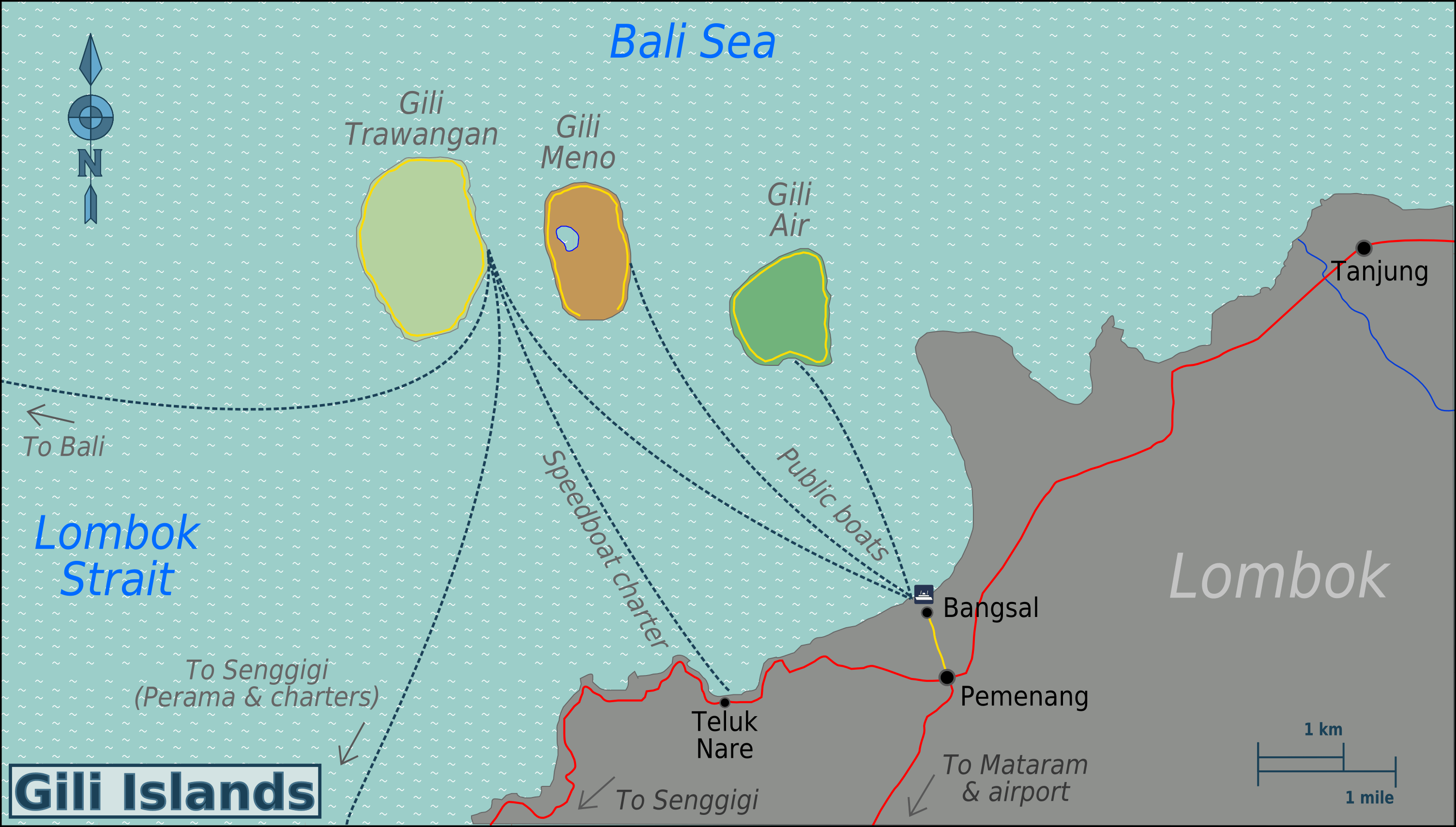
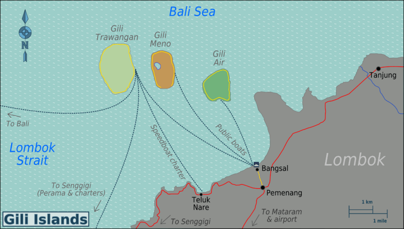
Image: Gili Islands Region map
Size of this preview: 800 × 455 pixels. Other resolutions: 320 × 182 pixels | 3,008 × 1,709 pixels.
Original image (3,008 × 1,709 pixels, file size: 701 KB, MIME type: image/png)
Description: Map of the Gili Islands region, Lombok. SVG, Lombok Map of: Lombok¤.
Title: Gili Islands Region map
Credit: :image:Gili_Islands_Region_map.svg
Author: User:(WT-shared) Burmesedays,OpenStreetMap
Usage Terms: Creative Commons Attribution-Share Alike 3.0
License: CC BY-SA 3.0
License Link: http://creativecommons.org/licenses/by-sa/3.0
Attribution Required?: Yes
Image usage
The following page links to this image:

All content from Kiddle encyclopedia articles (including the article images and facts) can be freely used under Attribution-ShareAlike license, unless stated otherwise.