
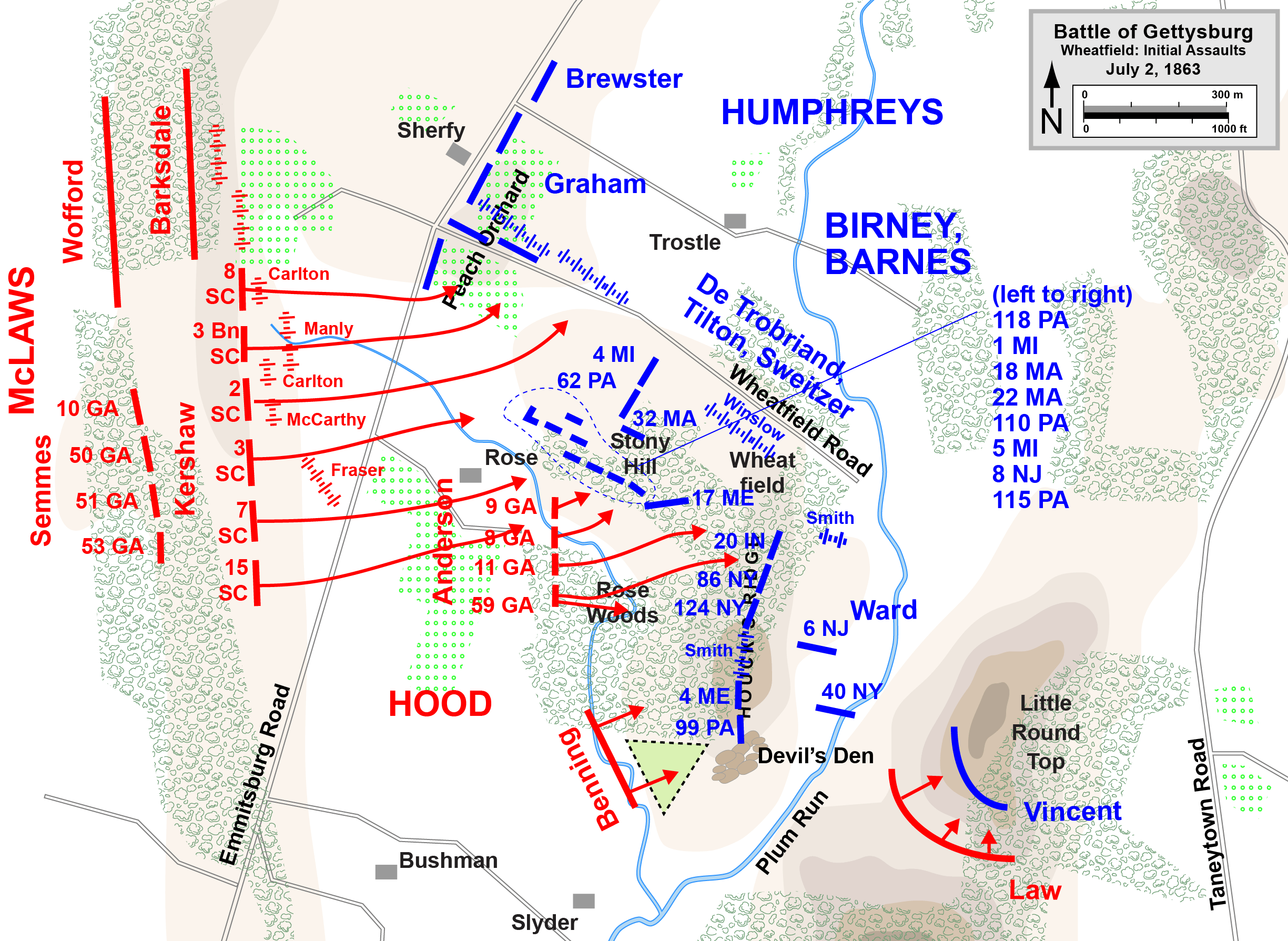
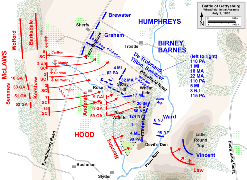
Image: Gettysburg Day2 Wheatfield1
Size of this preview: 800 × 584 pixels. Other resolutions: 320 × 234 pixels | 2,449 × 1,789 pixels.
Original image (2,449 × 1,789 pixels, file size: 466 KB, MIME type: image/png)
Description: Map of Wheatfield actions in the Battle of Gettysburg, Second Day, of the American Civil War. Updated unit positions and made topographical background consistent with many other Wikipedia Gettysburg maps. Drawn in Adobe Illustrator CS5 by Hal Jespersen. Graphic source file is available at http://www.posix.com/CWmaps/
Title: Gettysburg Day2 Wheatfield1
Credit: Own work
Author: Hal Jespersen
Usage Terms: Creative Commons Attribution 3.0
License: CC BY 3.0
License Link: https://creativecommons.org/licenses/by/3.0
Attribution Required?: Yes
Image usage
The following page links to this image:

All content from Kiddle encyclopedia articles (including the article images and facts) can be freely used under Attribution-ShareAlike license, unless stated otherwise.