
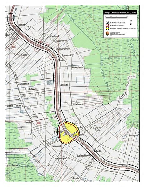
Image: Georgia Landing Battlefield Louisiana

Description: Map of battlefield core and study areas. The Study Area was revised to include the location of the Federal camp north of Napoleonville (from which Weitzel marched to intercept the oncoming Confederates) and the Confederate retreat route south to the point where Federal skirmishers broke off pursuit. The Core Area was expanded slightly to include the location of the Federal pontoon bridge over Bayou Lafourche; Union soldiers crossing at this point came under heavy fire from Confederate infantry and artillery.
Title: Georgia Landing Battlefield Louisiana
Credit: National Park Service
Author: American Battlefield Protection Program
Usage Terms: Public domain
License: Public domain
Attribution Required?: No
Image usage
The following page links to this image:
