
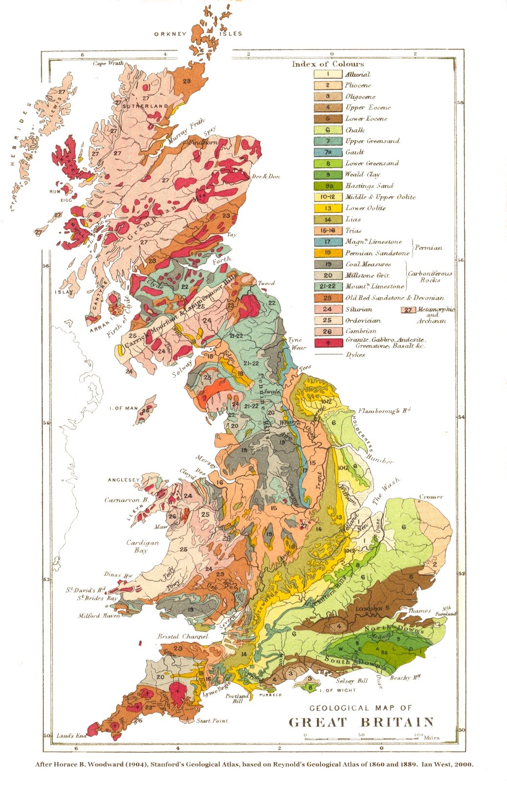
Image: Geological map of Great Britain
Size of this preview: 385 × 600 pixels. Other resolutions: 154 × 240 pixels | 1,036 × 1,614 pixels.
Original image (1,036 × 1,614 pixels, file size: 368 KB, MIME type: image/jpeg)
Description: A geological map of Great Britain and neighbouring islands (excluding Ireland).
Title: Geological map of Great Britain
Credit: Stanford's Geological Atlas of Great Britain and Ireland. London: Edward Stanford.
Author: Horace Bolingbroke Woodward
Usage Terms: Public domain
License: Public domain
Attribution Required?: No
Image usage
The following page links to this image:

All content from Kiddle encyclopedia articles (including the article images and facts) can be freely used under Attribution-ShareAlike license, unless stated otherwise.