Image: Geologic Map Dominican Republic

Size of this preview: 800 × 351 pixels. Other resolutions: 320 × 141 pixels | 1,348 × 592 pixels.
Original image (1,348 × 592 pixels, file size: 1.7 MB, MIME type: image/png)
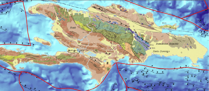
Description: Mzb are Mesozoic amphibolites and associated metasedimentary rocks, Ki are Cretaceous plutons, Kv are Cretaceous volcanic rocks, uK are Upper Cretaceous marine strata, Ku are Cretaceous sedimentary and volcanic rocks, K are Cretaceous marine strata, IT are Eocene and/or Paleocene marine strata, uT are Post-Eocene marine strata, T are Tertiary marine strata, V are volcanic rocks, and Q are Quaternary alluvium
Title: Geologic Map Dominican Republic
Credit: Map Showing Geology, Oil and Gas Fields, and Geologic Provinces of the Caribbean Region, USGS Open-File Report 97-470-K
Author: C.D. French and C.J. Schenk
Usage Terms: Public domain
License: Public domain
Attribution Required?: No
Image usage
The following page links to this image:

All content from Kiddle encyclopedia articles (including the article images and facts) can be freely used under Attribution-ShareAlike license, unless stated otherwise.
