
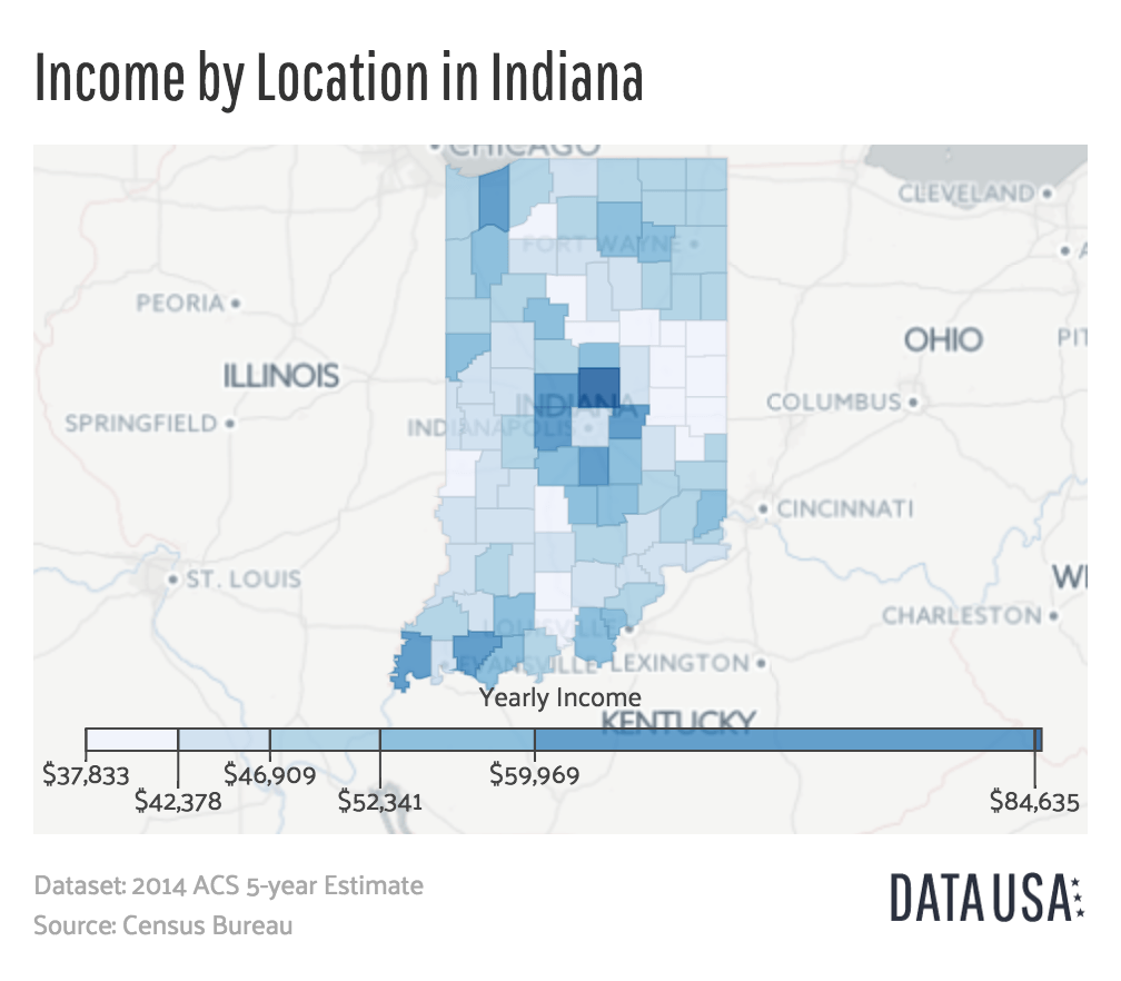
Image: Geo Map of Median Income by County in Indiana
Size of this preview: 685 × 599 pixels. Other resolutions: 274 × 240 pixels | 1,008 × 882 pixels.
Original image (1,008 × 882 pixels, file size: 309 KB, MIME type: image/png)
Description: Map of Indiana depicting the median household income by county. Data from 2014 ACS 5-year Estimate report published by the Census Bureau[1].
Title: Geo Map of Median Income by County in Indiana
Credit: http://datausa.io/profile/geo/indiana/#income_geo
Author: Datawheel, LLC
Usage Terms: GNU Affero General Public License
License: AGPL
License Link: http://www.gnu.org/licenses/agpl.html
Attribution Required?: Yes
Image usage
There are no pages that link to this image.

All content from Kiddle encyclopedia articles (including the article images and facts) can be freely used under Attribution-ShareAlike license, unless stated otherwise.